
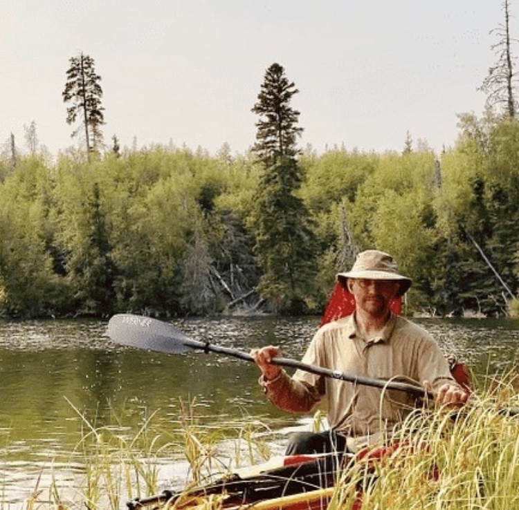
I’m started this post before setting out on a 1000 mile journey by canoe, alone across the northern boreal forest and Canadian tundra.
12 days before I started the trip I shot a video answering most the questions I got before the trip (what about bears, what kind of boat, will I be fishing, etc.) and going into detail about my plans.
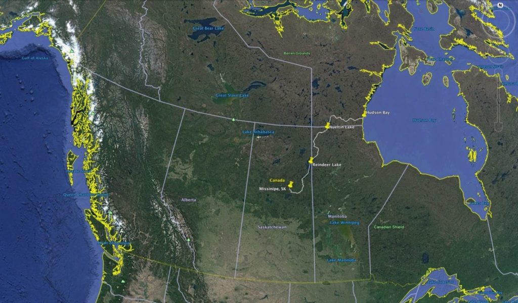
The Route
This was a roughly 1,000 mile (1,600 km) trip in 7 parts…
- Downstream on the Churchill River from Missinipe, Saskatchewan to the Reindeer River
- Upriver on the Reindeer River to Reindeer Lake
- North on Reindeer Lake to the mouth of the Cochrane River
- Upriver on the Cochrane River to the Thlewiaza River
- Downstream on the Upper Thlewiaza River to Nueltin Lake
- North on Nueltin Lake to the Lower Thlewiaza River
- Downstream on the Lower Thlewiaza River to Hudson Bay
Here’s a very large scale map of the route covered…
If you have Google Earth installed on your computer then here’s a Google Drive link for the kmz file for the route.
Highlight Video
I’m still working on the longer documentary movie (and possibly a book too), but for now here’s a short highlight video with some of the best footage I got during the trip.
The music is from Eva Schubert’s Hot Damn Romance album which you can download on Google Music, stream on Apple Music, or listen to on other streaming platforms.
I hope you like it!
Frequently Asked Questions
How long did it take, and did you really do this alone?
I planned and took food for 50 days, but then pushed ultra hard and got it done in 42. And yes, I did it completely alone.
How did you get the footage of you paddling for the highlight video?
Mostly I did it Survivorman style: go ahead, set up the camera, paddle past it, and then go back to retrieve the camera. Once I gave the camera to a fly-in fishing guide who happened to be on one of the rivers, and the Inuit who picked me up at the very end also filmed it. All that being said, I didn’t have a lot of opportunities to do extensive videography. I had limited food, an audacious goal, a very long distance to cover, and a rapidly closing weather window. So mostly it was paddle, paddle, paddle!
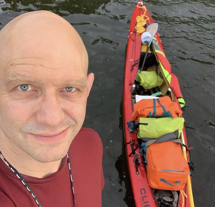
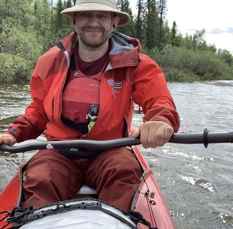
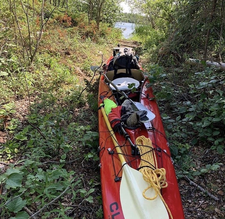
What did you think of the canoe-kayak hybrid you used vs a regular tripping canoe?
It was generally great although loading it with 50 days of food and gear was very challenging (and it was dangerously top heavy for the first week until I got rid of some gear and figured out how to get al the heavy stuff below the gunnels). That was definitely not the boat’s fault.
On the improvement side I wasn’t a fan of the portaging yoke, and if I did this again I would want a better system in place. Also I would have heavily modified the spray deck. I do not like suspender-based systems at all and would have modified it to be more of a Cliff Jacobson rapid exit style of cover.
All that being said, the lower profile made it possible to make at least some headway in very heavy wind conditions that would have blown a regular canoe back to the prairies. So I was very happy with that.
How much of the upriver stuff was wading/lining and were you able to paddle any of it?
I was able to paddle quite a bit of it. It’s Canadian Shield country and so at least 50% of it is lakes. But the Cochrane River in particular was quite difficult and there were long stretches where, if I paddled and stayed close to shore, I could make headway. It was a case of going as hard as I could for 10 to 20 minutes, then resting a bit and repeating.
How many pounds is 50 days of food? And does it fit all in a kayak? Did you have to do a resupply drop at all?
It was about 180 lbs and it didn’t fit very well at first. I was dangerously top heavy for the first week until I ate my way down, got rid of some stuff and figured out how to pack all the heavy bits low. There was no resupply. I did pass through 3 small native villages at which I bought some snacks but otherwise I carried everything. Had the store in those 3 towns been closed I would have been fine
What was the scariest thing that happened? Did you have a “Sh*t I nearly died!” moment?
Cornering the black bear or grizzly in it’s den at the abandoned fishing lodge on July 30th was definitely a close call. Then there was a bad moment early on in the trip on a big lake – the big lakes are definitely the greatest hazard!
Did you see many people?
Very few. In the first 20 days I passed through 3 native villages and 1 active fishing lodge where I saw people obviously, and also the occasional fisherman or boat on the lake. But it definitely wasn’t an everyday occurrence. Then for the last 22 days I saw nobody at all, not fishermen, prospectors, canoeists, nobody!
Did you at any point question why you were doing this?
Definitely, especially in the first couple of weeks before my body had adapted somewhat to the strains of travel. I even occasionally harboured secret fantasies about the boat breaking in a rapid and having a face-saving way of extracting myself from from the situation. Fortunately I recognised the old self-doubt demon for what it was and managed to talk myself off that particular ledge. I talk about this mental game at some length in this article here: grapplearts.com/7-tips-for-maintaining-motivation.
What’s your advice for other people that want to do something like this?
Start by building bombproof camping, paddling and navigating skills in difficult but low consequence settings
What piece of gear (other than the spray deck and yoke) was the biggest let down?
I was very disappointed when an ultra-lightweight carbon fiber bent shaft canoe paddle snapped just 6 days into the trip. Up until then it had been a joy to use and propelled me very efficiently across the lakes.
Which piece of gear performed better than expected
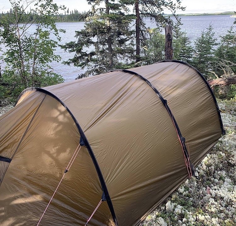
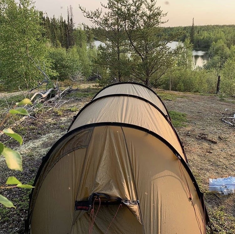
The Hilleberg Tent and the Pak Alarm bear alarm were spectacular pieces of kit.
Did you fish at all?
Sadly no. The fishing would have been astounding as there were huge lake trout breaking the surface of every lake and grayling in the rapids.
I didn’t fish for two reasons: one, I reasoned that any time available for fishing should be spent paddling, and two, fishing is a stinky activity – the smell gets on your hands and clothes. And avoiding food smells is essential for bear safety, especially when traveling alone.
How would you lighten your load next time?
I thought about this a lot. In fact whenever I made it to a town I mailed back a few extraneous items (camera tripod, drone, extra ammo, etc) but ultimately I don’t think I could have gone much lighter without doing one of the following
- taking less food (and risking running out if I had been windbound for a longer time),
- not taking a satellite dish (writing my near daily blog was my only source of recreation),
- not taking any bags of oil to add to my food (I ended not using extra oil in my food as much as I thought I would, and ended up burning most of it after one of the containers leaked in my food bag)
- not taking a stove and pots and just eating cold food.
I might have been able to save 20-25 lbs if I had done all those things.
How bad were the bugs?
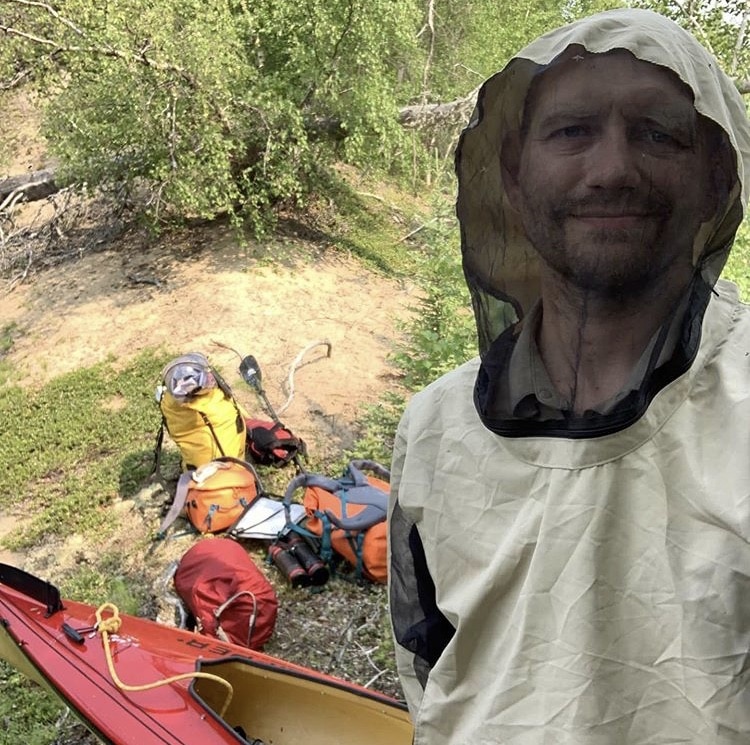
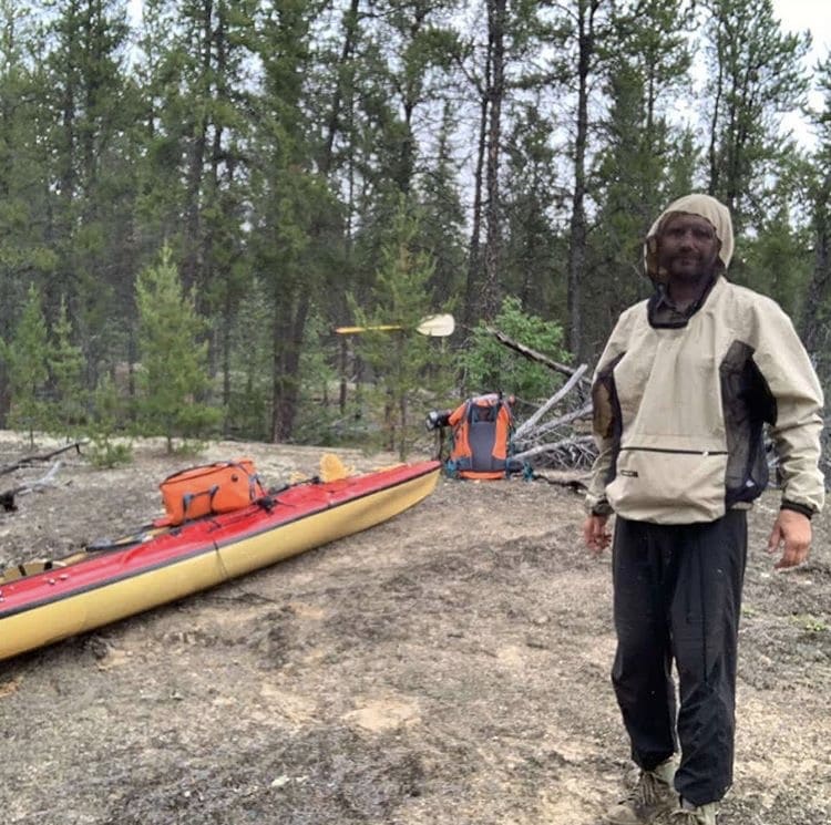
Absolutely terrible. After one portage I looked down and saw that I had spilled cherry juice on the front of my shirt. Then I realised I didn’t have any cherry juice and that the red stuff was blotches of blood where the black flies had snuck under the shirt and chewed my entire stomach and chest into a bloody mess.
For decades I have avoided the use of bug spray, including on other trips to the arctic. I have always relied on bug nets and clothing but on this trip that changed and I did occasionally use bug spray. For example there were days that they were so bad that unless it was windy the only way to get food down my throat was to first douse my face with bug spray.
How cold was it?
The coldest it got was about 5 degrees C at night. It could have been a lot worse – I didn’t get any snow for example. That being said when you’re continuously wet for 5 to 7 days at a time then it makes cool temperatures seem a lot colder. I wore rain gear over fleece every day for the last week.
Did you run many of the rapids? Are there a lot of Class III and higher on this route?
There are definitely lots of waterfalls and rapids, including some that would have been absolutely amazing to run in a dedicated whitewater canoe or kayak. But a wilderness expedition is no time to risk losing everything in a rapid you thought you could run. So I erred very much on the side of caution. I did run some long class 2+ and 3- rapids wearing full raingear, PFD and basic survival and communication gear strapped to me, but would often line, wade or slide the canoe around the worst bits.
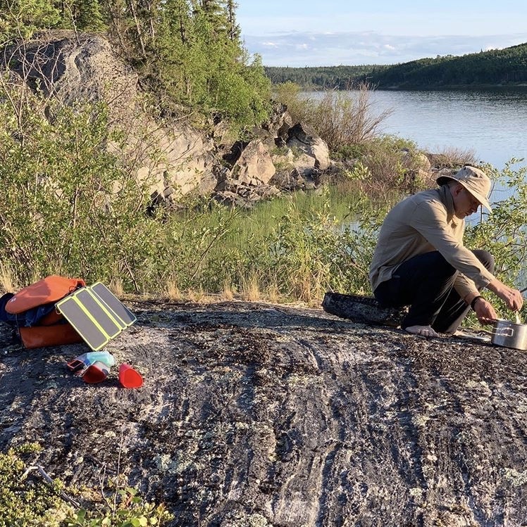
Pictures and Updates from the Field (aka the Trip Blog)
Once I started the trip this page then turned into a repository of updates from the field which I would update whenever I could charge small satellite dish with a solar panel and connect to highly spotty satellite coverage.
Here’s what I uploaded to my Instagram (@stephan_kesting) while on the trip…
June 29, 2019

And I’m off! 20 years ago I went down a map rabbit hole and started fantasizing about a river in Nunavut called the Thlewiaza. Flowing mostly through the tundra, crossed by herds of caribou, rarely visited and generally untrammeled by modern man it caught my imagination and never let go. It’s take some two decades to get myself into a position to get up into that country and explore it for myself, but that journey starts today.
First a flight from Vancouver to Saskatoon, then a puddle jumper to La Ronge, and then an hour’s drive to the hamlet of Missinipe. From there I travel downriver along the old voyageur route on the Churchill River, then hang a left and go upriver on the Reindeer River. Then I cross gigantic Reindeer Lake, head upriver (again) on the Cochrane, and cross over the height of land to the Thlewiaza where the journey to the barrenlands begins.
I’m bringing a small satellite dish so if the satellites align and the sun shines to charge everything then I’ll continue posting the occasional pic from the trip. If we don’t stay in touch that way then have a good summer everyone! And finally, don’t “follow your dreams”… instead force your dreams to happen with sheer willpower and every tool you have available.
June 30, 2019
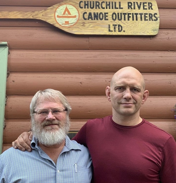
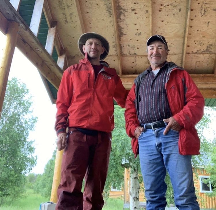
With Ric Dreidiger of Churchill River Canoe Outfitters. Even when you are going solo you are not doing it on your own. You are reliant on other people to give you an idea about what’s ahead of you.
There’s nothing that beats local knowledge when it comes to staying safe and traveling efficiently. Ric is the Godfather of paddling in Northern Saskatchewan; he’s been guiding trips and assisting paddlers up here for decades and you won’t find a more knowledgeable source of information (or a better human being) anywhere. I spent an amazing evening tonight with him and his family in Missinipe talking canoe routes, campsites, gear and stories. I guided for Ric in the 90’s and within 10 minutes it felt like I had never left.
Tonight I need to repack my gear and make sure it all fits in the boat. If not, well, I can always get rid of my camp chair and all but one set of underwear. Lord willing and the creek don’t rise I head off tomorrow downriver in the first leg of this journey.
July 1, 2019
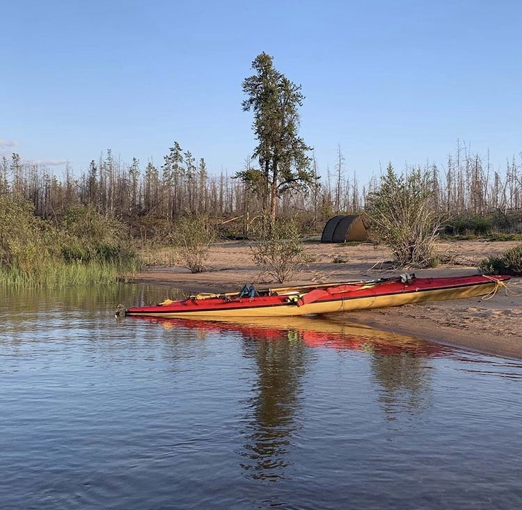
Well, this is one very heavily laden boat. Thankfully most of the heavy stuff is low against the bottom of the boat which makes it more stable, but I’m definitely going to have to spend some time reorganizing this stuff and, more importantly, eating my way down into the food supplies so that everything fits! Hitting the water now at 6:30 AM local.

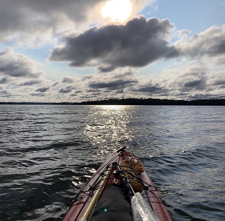
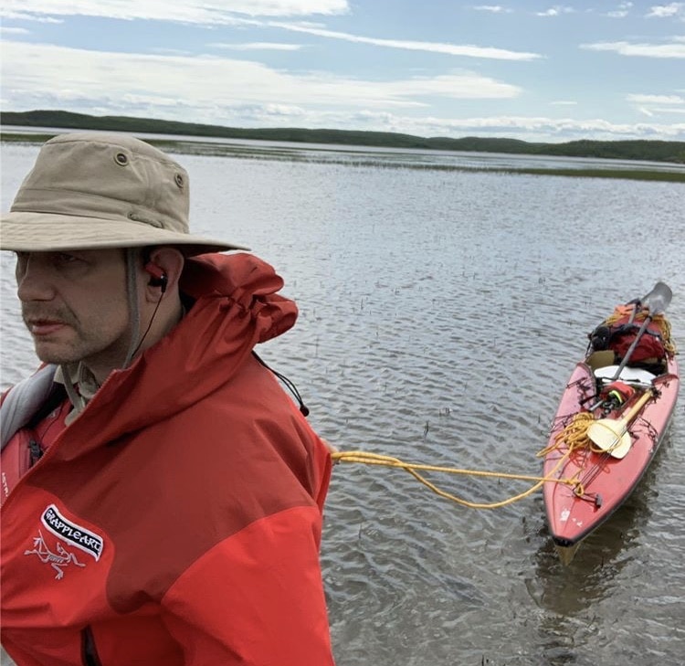
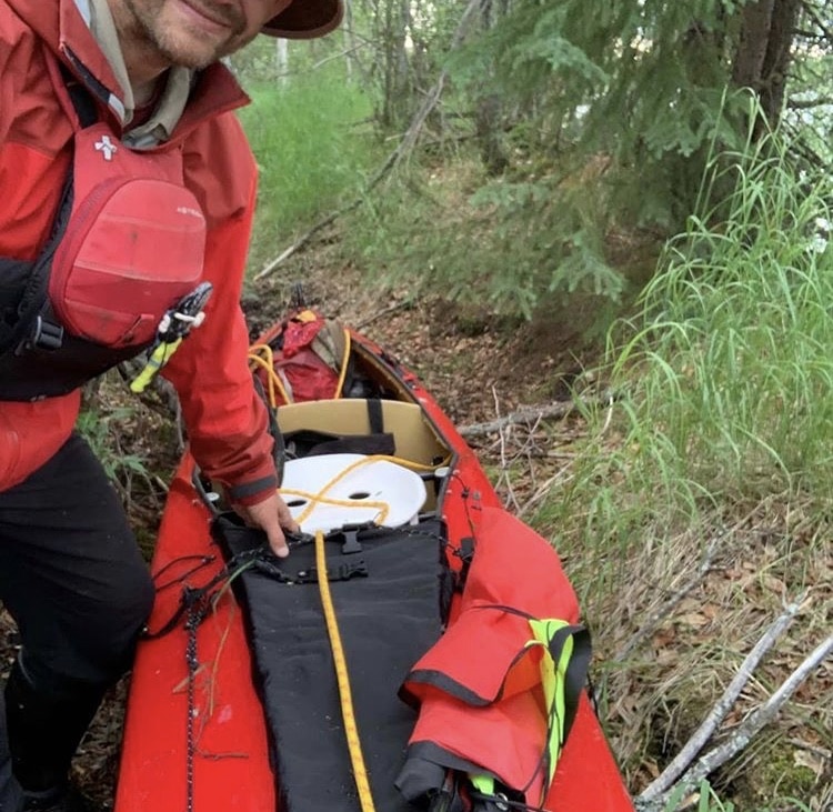
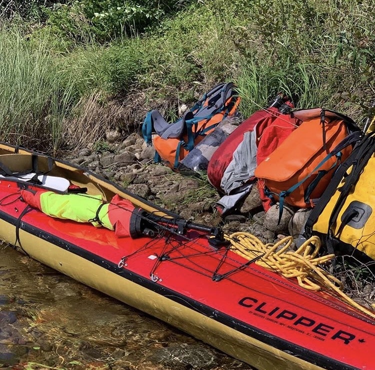
A couple of thoughts about my boat selection: the sea one is a fast sexy modern boat, but with 250 lbs of gear and 215 lbs of paddler Iʼm definitely at, or slightly over, its practical carrying capacity. Itʼs still fast when itʼs loaded, but it ride low in the water and turns like a pig. Iʼm definitely going to be very, very careful with the whitewater until I eat up 50 or 100 pounds of food. Secondly, since it is shaped more like a sea kayak then a regular canoe it makes the standard canoeing practice of having a few large bags for all your gear impossible.
One ends up stuffing gear into smaller bags and those bags into every nook and cranny of the boat. This works fine when youʼre on the water but makes portages much more challenging logistically. I already had to turn around once to go back to a portage to collect a missing item, so I really need to develop a rock solid packing and unpacking routine so that everything makes it back into the boat.
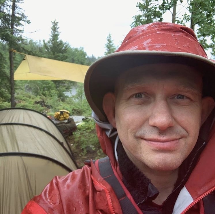
Today, as Dr. Seuss might say, was a cold cold wet day. On day one of my 1000 mile solo I got up at 4:30 in the morning to pack and say my goodbyes, and was on the water by 6:30 AM. In part this up before Jocko schedule is to acclimatize myself to traveling in the early hours when the bugs arenʼt as bad, but in truth it was also because I was so excited I couldnʼt sleep.
The rain started falling soon after and the west wind turned into a bitter cold north wind. This, combined with a few wet foot portages, meant I was pretty much soaked to the bone from mid-morning. Truly the most important piece of clothing for traveling to the north is bombproof rain gear; youʼre definitely going to get wet, but youʼre not going to get cold as fast as you would wearing city gear.
One of the portages today took me past Twin Falls Lodge which is a fishing cap nestled in the forest. I had had plans to punch on through, but when I was offered a cup of one tea I had to accept–it wouldʼve been rude to refuse, right? Well tea turned into a warm lunch and the full stomach made it easier to venture back into the weather. I finally made camp at 4 PM which is a little early but the point is to not become completely hypothermic.
Do you want to stop, warm-up, and eat some food before you can no longer use your fingers or make good decisions.
OK, time to do a few chores around camp, fix a few things, and dry out some waterlogged items. And then to bed… Somehow I donʼt think Iʼll have any difficulty falling asleep!
ARTICLE AND PODCAST: I took a small microphone on this trip and occasionally recorded short podcast episodes from the field. On the very first night of the 1000 mile solo I uploaded an episode about what most people get wrong about the idea of following your dreams.
These are short, pithy episodes and I hope you’ll enjoy them if you haven’t heard them on my podcast already. Click here to check it out or use the embedded player below…
July 2, 2019
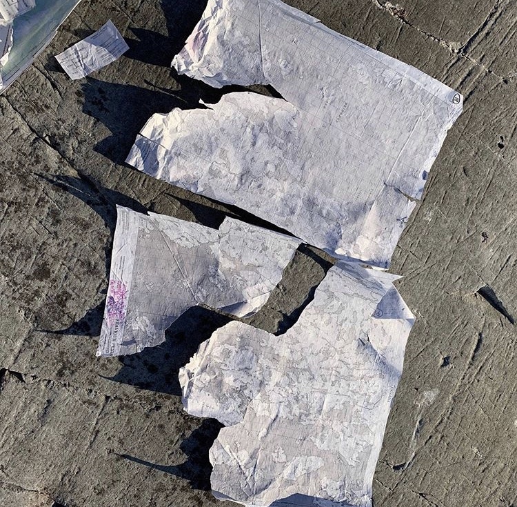
Completely wind bound this morning so the first order of business was to dry out the maps. These maps were in a (supposedly) waterproof case and had been treated by a (supposed) sealant to make them water resistant, but the first rule of northern travel is to assume that any waterproof container will leak unexpectedly and probably at the worst time. So when I opened the map case I found that ALL the maps were soaked, stuck together, and incredibly delicate. Separating them was like brain surgery and more than a few got shredded.
I got them quite a bit drier by leaving them in the open, weighed down by branches and rocks to prevent them from flying away. If any are destroyed beyond repair then I still have the option of navigating using my Garmin tethered to my phone, but I like it not: two is one and one is none, plus the electronic option would require very careful electricity management and regular access to direct sunshine which, so far at least, is in very scarce supply.
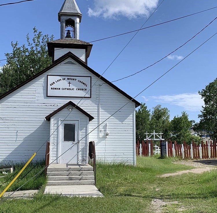
In the afternoon the wind shifted enough to get off my island where I had been wind bound, but it was still tough going. Really tough going. The wind was cold and horizontal and so was the abundant rain. Just when I pulled ashore ready to make camp in a horrifically wet spruce and sphagnum swamp the wind subsided enough to push on through to Stanley Mission…
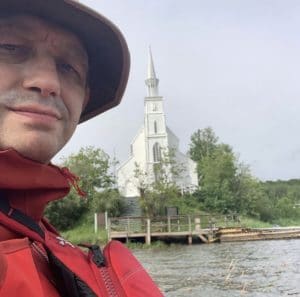
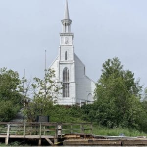
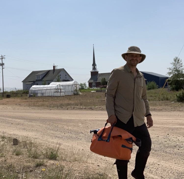
And finally, here’s something you don’t see everyday in the wilderness. This Anglican. church was built on the shores of the Churchill River in 1854 and is still used for special occasions by the local natives. It’s right across from the hamlet of Stanley Mission, which is one of 4 small native communities I’ll be passing on this trip. I might get to village number 2 (Southend) on about day 10, village number 3 (Brochet) maybe on day 20, and the last village (Lac Brochet) maybe on day 25. All of those times are very approximate because if this terrible weather keeps up then the going will be a lot slower than I would like.
July 3, 2019
I was up shortly after five and on the water by 6:30 AM. My goal was to cross a large lake before the wind came up. Itʼs amazing how much the wind determines things… a headwind can stop youʼre dead in your tracks, but a tailwind can be very dangerous too, especially if youʼre on a large lake where the wind speed and wave size tend to pick up the further down the lake you go. I do have a 1.4 square meter sail, and Iʼm quickly coming to some safety rules for it.
First of all, only use it in the light wind to augment your speed or maybe in a light to medium wind if everything else is perfectly optimal. Gusty conditions are very dangerous. Only sail where, if you wipe out, you will be blown to shore in a few hundred meters. Avoid at all costs sailing in an offshore wind because if your boat flips youʼre going for a very long swim. That being said, under the right conditions itʼs a very nice way to take some of the strain off your body and rest a little bit while still making forward progress (paying 110% attention).
July 4, 2019
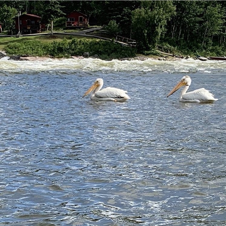
When people go into the wilderness they expect to see animals everywhere. The truth is that large animals are rare, and seeing one is a big deal. So far I have seen pelicans, loons, mergansers, mallards, red squirrels, bald eagles, ospreys, and frogs. I guess I should also mention that at my map drying stop mid day there were thousands upon thousands of newly hatching dragonflies everywhere. It was so neat to see the larvae crawl from the water, split in half, and watch a green dragonfly slowly emerge. I like dragonflies: they are beautiful but just as importantly they eat blackflies and mosquitoes!

Today was an insanely busy day. From about 5:15 AM to 8:30 at night I was working continuously. Breaking down camp, packing the canoe, eating a quick cold breakfast, paddling, portaging paddling, portaging, paddling, a quick stop at a sunny spot to dry out my topo maps that got soaked on day 1, then more paddling through a very boggy and swampy area and finally finding a spine of rock emerging from a wetland that was wide enough to pitch a tent on. This is my first fire of the trip, in part because it was the first day that wasnʼt mostly a torrential downpour, and secondly because it was the first day with significant black flies. The smoke really helps keep the bugs away.
Overall there is almost no downtime, and the amount of time it takes to get stuff done if magnified by my boat choice. It is a covered canoe (the Clipper Sea-One) that looks a lot like a sea kayak, so it is very fast and isnʼt affected by the wind as much as a regular canoe. However packing it with gear, especially when you have 50 days worth of gear, is an ordeal that takes at least 30 minutes.
With a regular canoe you just lift all your gear out and throw it back in; very quick and easy. With this boat Iʼm trying to wiggle giant packs into tiny little spaces and then tie everything down so that if I flip I donʼt lose all of it.
This portion of the trip is on the Churchill River, but really the river is mostly a series of large lakes connected by small, intense pieces of whitewater that I am mostly portaging because Iʼm not in a whitewater boat goofing around with friends ready to rescue me.
July 5, 2019
I believe your prediction of getting some is beginning to come true. Today was my 50th birthday and I spent it paddling into stiff headwinds, traversing large lakes, dealing with bears, paddling or lining my canoe down rapids, and bush crashing around those rapids too large to run or line.
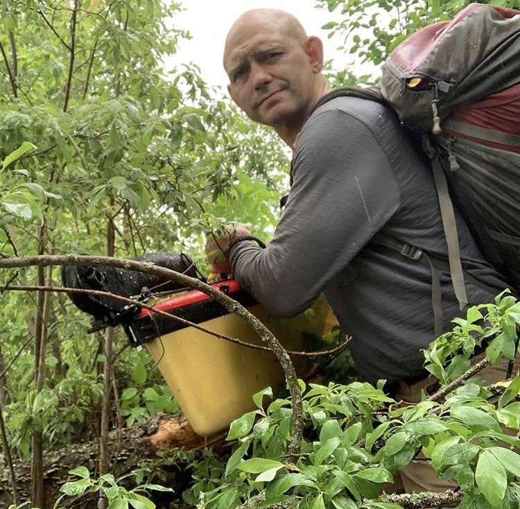
It is from a particularly memorable stretch at the bottom of Grand Rapids where I had to drag my boat through the brush, in the rain, soaked to the skin, and feeding black flies and mosquitos where this picture was taken. I am very grateful to everyone who has facilitated this trip and Iʼm thrilled that my post kidney transplant body with 5 decades of wear and tear hasnʼt fallen apart yet!
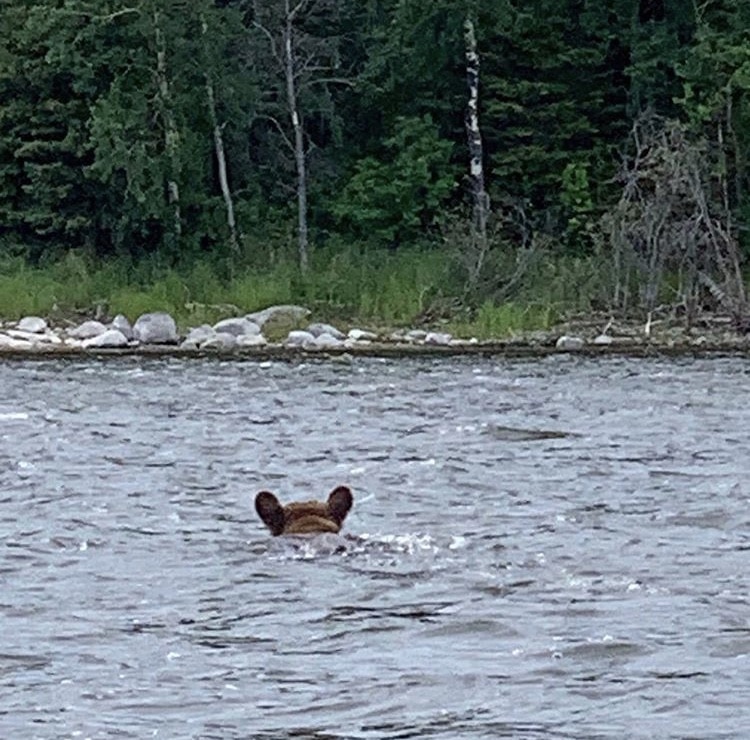
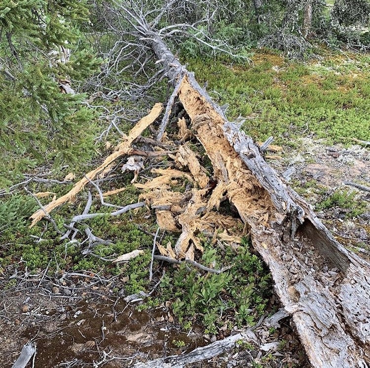
Bear!! This evening I was approaching a good campsite, which in some spots can be quite rare. It was on a small 700 m long Island with one suitable spot to pitch a tent. From a distance though I could see a suspicious dark spot moving around on the beach. A short while later it was confirmed: a two or three-year-old black bear.
He then plunged into the water to swim to a smaller island nearby which is where I got this picture. There was no way I was going to camp on an island, especially a small island, with a bear poking around. So despite being quite tired and ready to call it a day I continued on for another 6 km into a cold, stiff, north headwind to the next campsite.
I hadnʼt been planning to continue another 90 minutes, but on the other hand thatʼs 6 km (or about 0.4% of the whole trip) less that Iʼll have to do in the days to come.
July 6, 2019
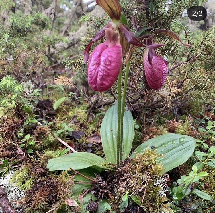
Not much to say here except that moss and reindeer lichen make for a very soft bed. And yes, sporadically I am taking time to smell the flowers.
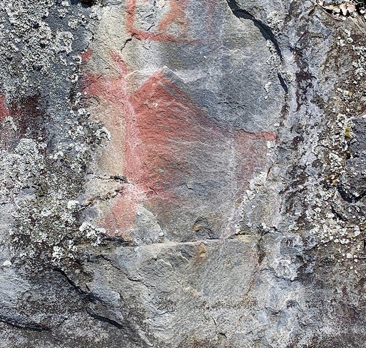
Red ochre rock paintings on the eastern shore of Uskik Lake, a reminder of the heritage of this area. Quite a few people asked me why I was doing this particular route, and the answer is that although it is not traveled much nowadays it was the old way north for thousands of years. The Cree and the Dene used it for trade, hunting and migration, and it remained important later when the natives travelled north to sell their their wares to the Hudson Bay company and other traders.
These rivers were once the highways of the land and by traveling them now I feel like I am a little bit closer to those ancient peoples. After a long day of fighting headwinds tonight I reached Ourom Lake which is where I leave the Churchill and start heading up the Reindeer river towards Reindeer Lake.
The Reindeer river is a little bit more sheltered than the Churchill which will make it easier with regards to wind, but heading up against the current is always challenging. A whole new bag of paddling tricks will be required…
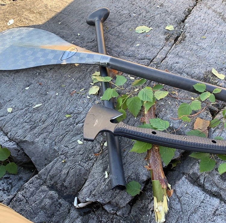
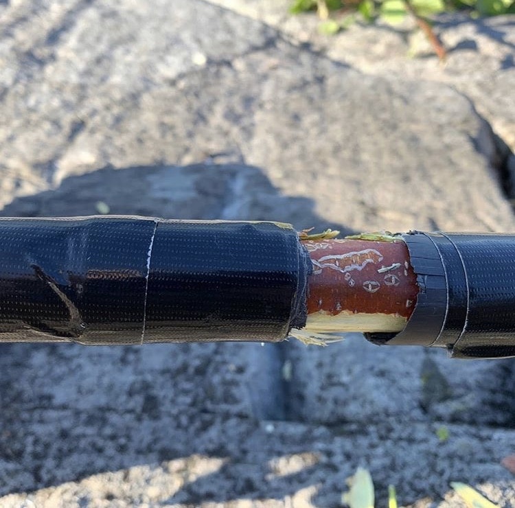
This carbon fibre bent shaft paddle was a joy to hold. It felt like you were paddling with air, and it was easy to maintain the high cadence that modern canoeing requires. Sadly as I was pulling out into the current beneath Kettle Falls it snapped in half with no warning. I didnʼt hit a rock and I donʼt think it had been previously damaged but I guess I gave it more of a power stroke when it was designed for. Fortunately I have spare paddles, including a heavy whitewater paddle that would make me want to shoot myself if I had to use it exclusively for the remainder of the trip. I hope my field repair allows me to continue using it (gently and lightly) to cross the many large lakes that are still on the route ahead of me.
July 7, 2019
The best campsite so far: high on a rocky ledge overlooking a still lake while the loons sing a concerto. On my previous long trips I had adopted a pattern where every six or seven days I take a half-day off. This is for rest and recuperation, as well as for repair of the inevitably broken items. I had been planning to make today such a half-day, but today I got incredibly lucky with a persistent tail wind and so I had to keep going and turn good weather into miles. My body is getting quite sore, my lats in particular, but Iʼll rest it on a day when I have a cold rain and a headwind!
My repair activity for the day was to assess the damage and attempt repairs on the last of the water damaged maps. This was totally my fault because I took untested, unproven map cases and untested, unproved waterproofing, and then trusted one of my most important assets to them. All mission critical items should be tested and re-tested before the trip and not subjected to not trial by fire (or water rather) on the trip itself. I am all of a sudden very glad that I brought both 1:250,000 AND 1:50,000 maps. Between the duplication in the maps and occasional use on my Garmin I should be able to figure out the route most of the time!
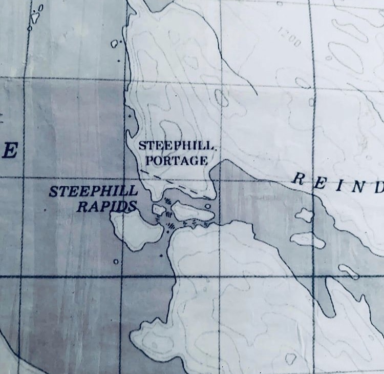
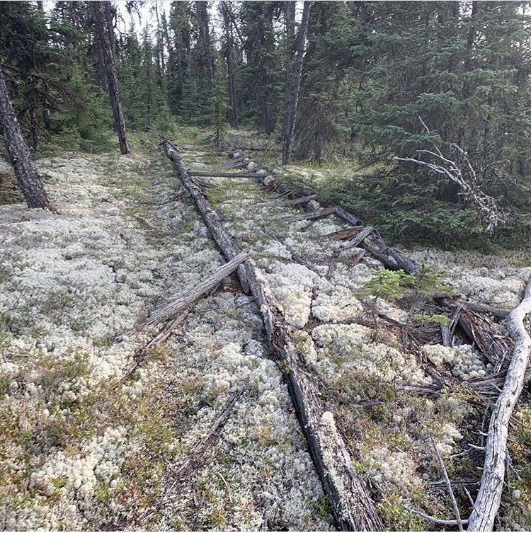
Steephill Portage… Hah! I have had a lot of hard portages in my time and this one was right up there. First of all it was long. Second of all it was very steep in places. And third of all it didnʼt exist. Whatever route existed back in 1985 when my map was created long since been reabsorbed into the forest.
I found an area where it might have gone – the trees were slightly smaller – but basically the whole thing was one long giant bush crash. Took five trips, three hours, I had to drag the canoe through the dense trees most of the way, and I felt drunk with fatigue at the end. It just goes to show you that maps are a starting place and that just because something is shown you canʼt rely on it being there, and just because something isnʼt shown doesnʼt mean itʼs not there.
ARTICLE AND PODCAST: Here’s a short rant recorded in the field about the realities of wilderness adventure and how it’s very different from what you see on someone’s Instagram – my own included!
July 8, 2019
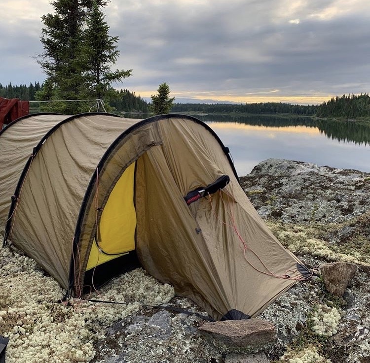
Finally setting up my Hilleberg Keron 3 on a small island in Royal Lake. These days are very long: I woke at 6:20, was on the water by eight, and have just finished dinner and clean up at 9:30 pm. In between there was zero discretionary time: I was either packing, unpacking, carrying gear, cooking, setting up a tent, repairing equipment, etc. This route is very ambitious in the time available, and the truth is that I may not finish it if there are unexpected delays. Even if there are no delays but Iʼll have to push as hard as I can every day that I can travel.
Days that I am windbound will be my rest days. If Iʼm too tired to paddle and thereʼs a tailwind or downstream then I should just sit in my boat and float. Of course that was a little bit harder to do today, given that there was a headwind and that I was going up river. Really my only optional indulgence is doing my nightly Instagram posting, which I enjoy and I hope you do too!
July 9, 2019
Isometric bodylock practice on one of my two heavy food bags.
The stretch of river between Steephill lake and here, just below Devil Rapids, is flat and unremarkable. It runs through flat terrain and is either channelized between willow-lined banks or passes through large lakes lined with spruce, alder and poplar.
There arenʼt very many good campsites on this stretch, so I was thrilled to find this one outcrop of rock at about 6 pm rather than try to make muddy camp in amongst the bushes and reeds (you should be able to see exactly where Iʼm camped by going to the top post at grapplearts.com/ articles and looking at the embedded map).
Suffering hard during the day is made much more bearable if you know youʼre going to have a dry camp and a decent rest at the end of the day. The small pleasures of life… Although somewhat monotonous, the day was still quite challenging. There was a continuous headwind, sometimes combined with an oncoming river current.
Either of them on their own would drive me back at about 1 to 2 km an hour, so there were times I had to put in 4 km an hour of effort just to stay in the same place. Oh, and it was drizzling and cold for most of the morning. 10 hours of pushing uphill against water Iʼm happy with my effort Iʼm not thrilled about the distance I covered today. Still, itʼs all part of the game, and tomorrow is another day.
On a sidenote, on past solo trips I’ve paddled in silence and never used music or audio. This trip I am experimenting with it though, using headphones about half the time on the water. That still leaves lots of time for thinking but also provides some distraction from the repetition.
To date I have made it almost all the way through Mike Duncanʼs amazing history of the French Revolution on the Revolutions Podcast (history nerds check it out). And yes, there are some tunes involved as well.
Today when I was starting to get very tired I was listening to Eric Clapton unplugged album and one of the thousands of Grateful Dead bootleg albums. They had the right rhythm for putting in stroke after stroke, mile after mile.
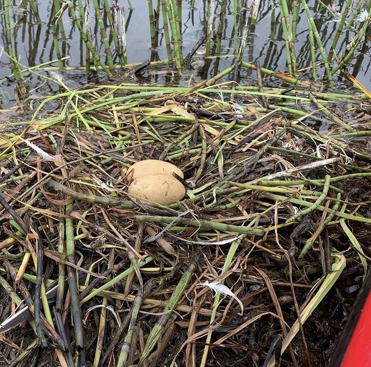
Hauling my canoe across the lake… Today was another long day of battling headwinds, so I thought I would be clever and go through a shallow area of the lake to at least avoid the choppy waves. Unfortunately that part of the lake was REALLY shallow and I had to get out and drag the boat across the mud flats.
The upside of the long drag was that I found a really unique bird’s nest. Constructed mainly of hollow horsetail stems it floated on the water and had two elongate yellow eggs in it. Anyone know what species of bird that is? I’m not able to check comments right now but I definitely will check in August when I get home.
It must seem like I go on about the wind every day, but it really is critically important. I’m guessing that the level of headwind I’ve faced on at least six days of the first nine days of the trip adds up to an additional 60 to 100 km of distance I could have made. Obviously I knew what I was getting into, and this is one of those categories where I need to deploy serenity and accept something I cannot change.
But the big test is coming up… Tomorrow morning I will arrive in Southend Saskatchewan at the bottom of Reindeer Lake. This is an absolutely gigantic lake, 250 km long and 30 to 40 km wide in places. If I run into bad wind conditions there you could set my timeline back so badly that I would need to consider modifying the destination of the trip. If things go well on the giant lake then a major hurdle will have been overcome and I will be much more confident about finishing the trip.

Portaging around Whitesand Dam at the bottom Marchand Lake, a short distance as the duck flies from Reindeer Lake. Because of the covered canoe I have to pack in many small bags instead of a few large bags. So man, does it look like a lot of stuff…

Tonight I am camped about 2 km south of the town of Southend. I would have no issue with heading into town tonight – I’m not that puritanical when it comes to the wilderness – but the only accommodation would be a 5 km walk up the road at a fishing lodge, so that isn’t going to happen. And I don’t want to camp any closer because these villages always have tons of dogs roaming around, so I’m better off here for the night.
The last time I was in Southend was more than 20 years ago. I have been brought into teach a canoeing course to the youth, ages 8-14 if I recall correctly. Instead of all the different age and gender groups coming down one at a time as had been the plan, all 40 kids showed up at once. So it was me, a Cree elder, two totally apathetic local teenage “helpers” and 40 kids. It was total chaos and a ton of fun. If I see someone there in the right age range I will ask if they remember that crazy day.
July 10, 2019
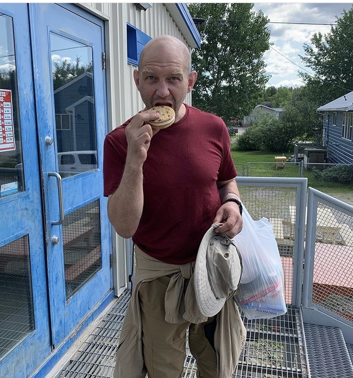
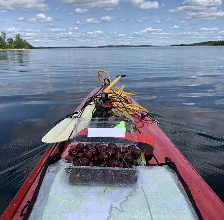
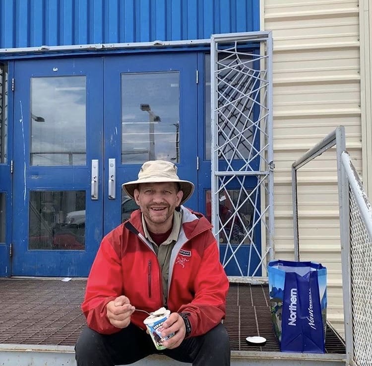
A quick stop in the native town of Southend to pick up some supplies, mail off my broken paddle, eat an ice cream sandwich, and now paddle of onto a giant (currently mirror smooth) lake fueled by pretty good Okanagan cherries.
July 11, 2019

An unexpected evening of socializing on Reindeer Lake! Iʼve been on other large lakes but none have been so complicated, involuted and be speckled with islands as Reindeer Lake. There are bays you can go down for 60 km if you make the wrong turn, so knowing where you are at all times is absolutely critical. The advantage of all these bays and islands is that you have options. You can use them to shield you from the wind and waves as well as have them in your back pocket as potential bail out points on the longer crossings.
Since leaving Southend yesterday at about 11 am I spent the day taking advantage of the placid conditions and the light tailwind while sneaking up channels and hugging islands in case the weather changed (which it didnʼt).
A few fishermen and natives traveling to Kinasoo and back were also on the lake, speeding along far away with their outboard powered Lund boats. So In the evening while approaching McFarlane Island I was quite surprised to hear music. Was there another camper or cabin owner with a ghetto blaster cranked up all the way perhaps?
After a quick search the source of the music became evident: there was a huge celebration going on with at least 250 people. It was the 20th annual Family Camp of the Peter Ballentyne Cree Nation. I wasnʼt angling to attend but I quickly got invited up for a cup of tea by Victor and that soon turned into a delicious dinner, socializing and even a place to stay for the night!
At the Peter Ballentyne Cree Nation Family Day I met former Southend band councilor Hector Morin. He had been raised on Reindeer Lake by his father who had fished commercially here in the 50ʼs and 60ʼs. Hector took the time to go over my route and make some suggestions for navigating this large, beautiful and potentially dangerous lake.
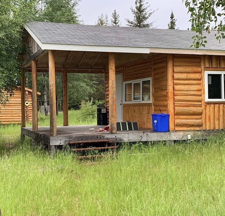
Later as I was preparing to leave he offered the use of a mostly finished cabin at his nearby camp on the same island. Not wanting to pass up the opportunity to spend more time with someone as locally knowledgeable as this man I eagerly accepted as soon as soon as it became evident that it was an honest expression of northern hospitality. So last night I got to be nice and dry while listening to the rain drum on the roof of a mostly finished but absolutely waterproof and bug proof cabin!
1000 thanks to Hector for putting me up and sharing his deep knowledge of the area. He guides for Lawrence Bay Outfitters so if you want to know where all the giant lake trout and pike live in this lake make sure to ask for him!
July 12, 2019
Today was spent crossing from the west to the east side of Reindeer Lake. Conditions were ideal: very still, almost plastered. Even so, aware that the weather could change at any time, I orienteered from shelter to shelter, skirting MacFarlane Island, Preistly Island, Mooney Island, Milton Island, Shaw Island and am now camped on Upistukik Island.
My Garminʼs very rudimentary weather days that there could be lots of wind tomorrow afternoon.
Even though I am planning on a sheltered route up the Eastern shore this could be problematic. Accordingly I am going to bed very early tonight and getting up at 5 AM so that I can make the most of the morning, that time of day usually having less wind about normally.
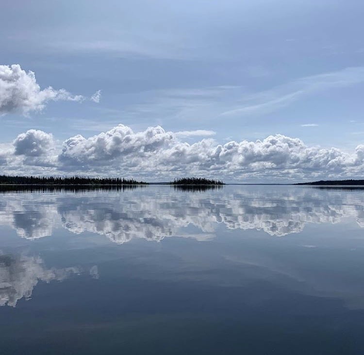
Because the waves can get very large on this lake the shoreline can be blasted at times, which makes for a very picturesque journey. Some islands are sand heaps, most are jumbles of cobbles on bedrock, and some are smooth half domes of granitic rock just barely coated with mosses, lichens and spruce trees.
The fact that this area was still under ice in the last glaciation 8 to 10,000 years ago is evident everywhere. On a worrying note I am having problems charging the satellite dish I am carrying that allows me to make these one way updates from the field. Fixing that is tonightʼs priority (after eating of course).
If I get it fixed then great, business is normal. Lots of updates from the field. If I canʼt get it fixed then these updates will become more rare. Maybe a single photo every three days or so. I apologize for this, and Iʼm also sad for myself, because a record on Instagram means that if my camera sinks to the bottom of the lake then lʼll still have at least these pictures! Two is one and one is none, always!
Well, if you have to be wind bound you could pick worse places to wait! Thus nameless granite slab of an island, covered with spruce, moss and lichen, is very pretty! Itʼs day 12 of my trip and Iʼve been putting in 10 to 12 hours of continuous work every day, straining against the current, wind and kilometers by paddling, portaging and lining along this route.
But today I only paddled for a couple hours before being driven to shore by a rising wind and some larger upcoming crossings.
Too use the time Iʼve bathed, napped, done laundry, and repaired equipment. The hope is to of get back on the water later this evening and click off some more seconds and minutes of latitude as I drag myself north. Until today I hadnʼt taken a single rest day because I knew that on a body of water as large as Reindeer Lake rest days arenʼt optional; you get them whether you want them or not.
The wind can really blow on this lake and since it can work on the water for such long distances the whitecaps build up very quickly making it no place to be for a small canoe. Look up Reindeer Lake in Google Maps if you like to see how big it is but the long story short is that if the wind is blowing I ainʼt going!
A day of mostly rest will do my body good. Iʼve been pleasantly surprised by how it has adapted to the strains of this trip, and especially by how it seems to have been the perfect physiotherapy for a few pre-existing injuries; my shoulder and elbow injuries are feeling better, not worse, after all this paddling.
Itʼs amazing what 20-30,000 paddle strokes a day will fix! For the last few days, however,there has been a growing sense of systemic fatigue which I attribute to over training and under resting. Thanks to Mother Nature for making me stay put today and giving the body time to rest up!
Storm inbound on day 12. The wind abated somewhat at about 6 pm presenting the opportunity to break camp, pack the boat, and bolt across the a few bays to a less exposed location. Plus knock off 6 more km of the journey. Paddling during magic hour was amazing; the evening sun brought out the full colors of the trees and rocks.
I made it to a stellar new campsite at the north end of the Malcom Peninsula from which I should be able to head northeast and duck in behind Malcom Island, getting to the so-called ‘inside passageʼ. Thatʼll provide protection from all but the most severe winds for at least a day. As I was paddling I noticed the cumulonimbus clouds building up in the West, and by the time I made camp it was clear that there would be some heavy weather soon.
The Hilleberg tent was pitched in record time with extra guy lines fixed to trees, logs and rocks. The canoe was tied down and filled with rocks to stop it from blowing away. Dinner was a hasty protein shake and a nut bar. Then quickly into the dry tent to have raindrops the size of grapes explode on the roof with the roll of thunder in the background.
ARTICLE AND PODCAST: Here on my podcast (The Strenuous Life Podcast) is a short episode about what drives me to occasionally head into the wilderness completely alone and without backup. I get asked this question a lot and I hope my answer is satisfactory.
July 13, 2019
Slogging on day 13. Most of the day was overcast, it was usually raining, but the headwinds were relatively light and the water was smooth so it was time to motor.I started paddling at 7:20 am and except for a few very short breaks didnʼt stop until 6:40 pm. So 11 1/2 hours to travel by Bjornson, Leblanc and Kroeker islands, then up Jackpinr Narrows (where I met two Wisconsin fishermen and Walter, their Cree guide), then past Kinoosao Bay (no time to visit that hamlet), past Moose and Walsh Islands until I found a great campsite high above the water with a view of the giant expanse of water that is Reindeer Lake.
Itʼs wide enough at this point that weʼre dealing with curvature of the earth issues because I canʼt see the far shore. Fortunately the sun came out for the last couple hours of the day. Dinner was quick: a US army MRE. All Iʼve got to say is ‘blech!!!ʼ – I feel sorry for the soldiers subsisting on these things and Iʼll take my dried food anytime!
For the entire day I wore light nylon shirt and pants with heavy duty Arcteryx rain gear (Grapplearts edition), my yuppie-but-oh- so-useful Tilley hat, leather gloves and calf high neoprene booties. This mostly kept me warm enough except in the late afternoon when the rain really started coming down, but then the answer was just to completely zip everything up and paddle harder.
Iʼve been thinking about some of the tricks I use to stay motivated during big projects, be they the milesolo paddles, getting my BJJ black belt, getting an MSc, building a business, etc. There are definitely some commonalities. I need to clean this up when Iʼm not so tired, but here they go…
1) Use the power of momentum.
2) Break the task into small pieces.
3) Use small rewards to mark the completion of those shorter legs of the journey.
4) Donʼt worry about everything; prioritize on the one thing that you have to get done today.
5) Continuous course correction. No matter how good your plan is you will continuously have to adapt it.
6) Use social pressure – announce your big audacious goal publicly and it will make it harder for you to pull the pin when times get tough.
7) Recognise that self doubt is normal.
MOTIVATION ARTICLE AND PODCAST: If this is a topic that interests you then I go into much more detail about these 7 tricks to maintain motivation in this extensive blog post and podcast here.
July 14, 2019

Perfect conditions on day 14! Today alternated between still conditions and a light wind that was mostly at my back. It felt so good to paddle and not fight a headwind, and even better when I got a 1 to 2 km an hour assist using the sail in the wind.
At 6:20 PM I pulled over to a nice campsite, but before I got out of the boat I asked myself, “Have I really done everything I safely can?”. The answer was no, so back into the boat I went for another hour and a half, putting in 11 1/2 hours today. My GPS tells me I am 38.6 km from my last camp, but that is in a straight line. Once you factor in all the detours around islands, up channels, and avoiding large open bays itʼs probably well over 45 km, which isnʼt bad for one person in a boat that still has 35 days of supplies in it!
One huge relief is the successful rounding of Porcupine Point. This bit of land is very exposed to wind and has a HUGE expanse of unprotected water all around it. I had been worried that I would have to do it at night to do it safely, but the conditions today were optimal for that crux move.
Have I mentioned before that I absolutely love the sound of loons calling? So absolutely iconic in this landscape, not to mention beautiful and totally unique. Once I hear that it takes me back to every other trip Iʼve done up north.And hey!! I just crossed into the province of Manitoba about 500 meters ago! Next border: Nunavut!
July 15, 2009

Windbound for most of day 15. Despite being only about 30 km from the Brochet reservation and the Cochrane river at the start of the day progress on Reindeer Lake was stymied this morning by a strong north wind that had whipped up whitecaps. Instead of struggling in the waves, always a dangerous proposition on a lake this size, I laid low. A few naps to repair the body, a bit of tape and glue to repair gear, and lists written out to organize my time in Brochet when I get there.
Often these strong winds start to decline in the early evening so I ate a large dinner at 2 pm in preparation for a possible night paddle. The waters started to smooth out by 5 pm, so I paddled from 6 to 9:45 pm, covering 18 km as the bird flies but more like 24 as the fish swims.
Being windbound occasionally is just what you sign up for when you’re doing trips that involve large lakes. You just need to be ready to seize opportunities when they arise.
Camped tonight on a small nondescript beach with suspicious 1-2 day old tracks in the sand, almost certainly bear. I set up my bear alarm system for the first time tonight – the only downside is that if the alarm goes off it’ll scare me just as much as the bear!
July 16, 2019
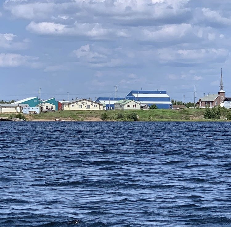
Got up at 530 am, on the water by 630, and with the help of a favorable tailwind completed the last 32 km to the native town of Brochet in record time. It’s a small, dusty, friendly town and yes, they have ice cream sandwiches at the Northern Store. Also sent back about 15 lbs of excess gear – tomorrow I start upriver on the Cochrane River and will feel every extra pound paddling against the current and lining/dragging through the rapids. Next civilization stop: Lac Brochet!

Day 16 continues! Today started early and ended late but man, was it ever worth it. Had fantastic weather conditions and tailwinds are more important than sleep. Made it from the last campsite on Reindeer Lake to Brochet in about 7 hours (630 am to 130 pm) and then spent about 1.5 hours in town. I ate an ice cream sandwich, bought a bunch of calorically dense food (ahem, cookies and brownies), mailed back a bunch of unneeded items, and called home. It was good to talk to people not constrained by the limitations of a sat phone.
Then took off from Brochet and crossed several bays to the mouth of the Cochrane River. Much to my delight the tailwind has become very strong – too strong to use out on the lake but perfect for getting blown upstream with a paddle assist. The river is very high right now so it was great to sail up the riffles rather than flailing through the willows while working tracking lines. With the help of the wind I made it 10 km up the river by 7 pm and only had to wade the boat upstream once.
Then I reached the mighty Kamechayt rapids which were impassable. On the east side of the rapids was the best portage trail ever – a broad and easy to find trail through a dry lichen-filled forest along the remnants of an old boat skidding track.
Here were also the worst black flies Iʼve had on this trip by far. I vaguely remember that black fly larvae need moving water and if thatʼs true then these rapids certainly provide an optimal habitat for the insane amount of bugs. Safely in my tent I can hear the drizzle falling, except itʼs not drizzle itʼs thousands of black flies hitting the nylon.
This section of the trip is going to be quite difficult. Upstream is never easy and itʼs harder at higher water. But there is nothing to do other than press forward. Push as hard as I can every day without getting injured or losing my boat and all the gear to the river.
July 17, 2019
Today was 12 1/2 hours on and in the water. Thatʼs a super long day but it was worth it because Iʼm now in esker country! Eskers are these giant hills of sand that ribbon their way across the landscape and make for great camping!
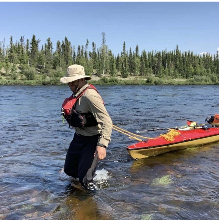
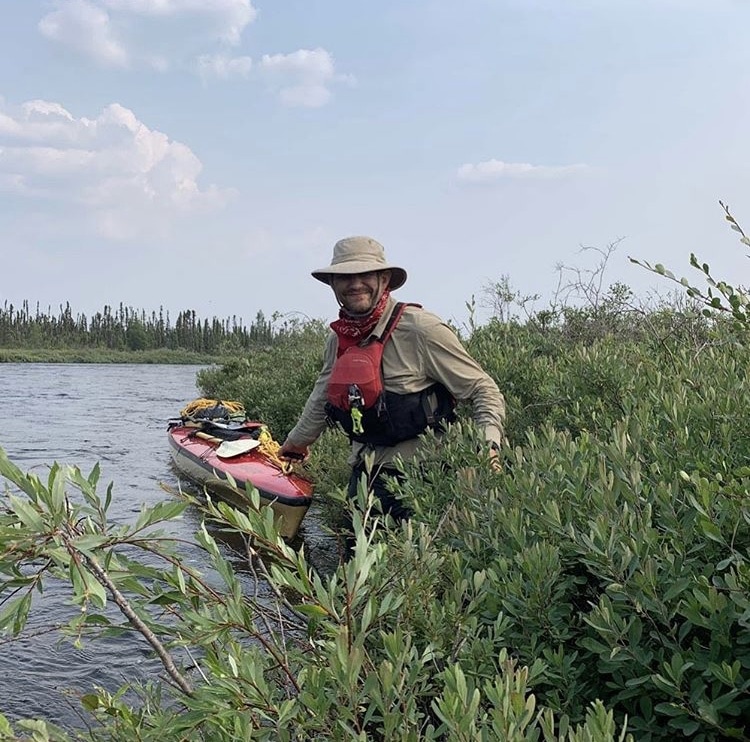
The river is very high right now – the rapids extend into the willows at either side of the river often – and that makes upstream travel difficult. Wading or tracking your boat requires you to claw your way up over slippery rocks in moving water while clawing your way through branches extending from shore whoʼs sole goal in life is to push you deep into the current where you and your boat will be washed away.
Today began at the Kamechayt rapids which had a beautiful mandatory portage path on the eastern side of the river (although it would be difficult to spot the top end of that portage if you were coming downstream).
2 km north of those was another unnamed rapid, unrunnable at this water level and definitely requiring a portage. Fortunately there was an easy trail on the rocks just to the west side of these wraps. The problem with portaging is not necessarily carrying the gear – that sucks of course – but the real problem is loading and unloading your boat. With my specialized dart of a boat even a 10 foot portage takes an hour.
The Waputonisk Portage was neither findable nor necessary. I tracked, dragged, and waded the boat up the western side.
The Kasakweeseeskak Rapids were horrendous. Definitely the hardest wading I have ever done. I went up the western side but it was a massive struggle because bushes here extended about 5 feet out over the river. Many times I had to go ahead and break branches to clear a path to drag the boat up through the rapids. I was going about 10 feet a minute and it was a LONG ascent.
The Kamacheechawasik rapids werenʼt too bad. The high water had created a new stream through the forest on the bottom west side so I simply tracked my boat through the bushes and trees. I definitely left some fiberglass, resin, and paint on those rocks but the other options were unthinkable.
July 18, 2019
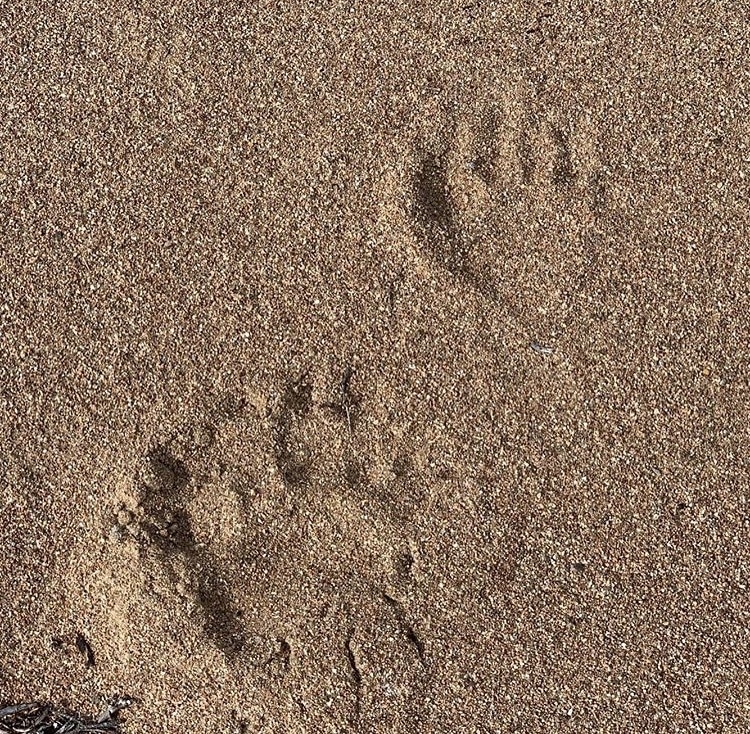
Iʼm at a fantastic campsite. Beautiful, open, not too many bugs, and a beach. Itʼs made even sweeter by the fact that I havenʼt seen very many campsites between the one I was at last night and here on the river.
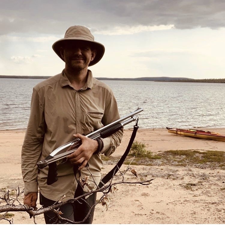
The only problem is that there is a lot of bear sign. Tracks, scat, and logs torn open. Now I certainly donʼt carry a gun every time that I going to the wilderness, but for going this far north, especially to Polar Bear country near Hudson Bay, you probably should carry something. So Iʼm quite glad to have my folding stock 12 gauge Winchester marine with me tonight. That and a really cool device I have called a “Pak Alarm” which is a well designed and reliable tripwire based bear alarm you string around your tent. I try to design something like this once, and trust me, the Pak Alarm is everything I wanted to make except better.
Today I travelled from Kapuskaypachik Lake up to Cann Lake against a mild current and headwind the whole day. Thatʼs 26 km as the bird flies, 30-32 as the fish swims, gaining 4 meters of elevation in the process. When it comes to upriver travel itʼs not just the kilometers, itʼs definitely the elevation change as well.
Anyone else doing the Cochrane river should know that there really arenʼt many campsites on the river section between these two lakes at high water. Just endless winding river with thick willow and spruce on the shores. The campsites that do exist are all associated with the eskers and drumlins. That being said, Cann Lake has many fabulous campsites, likely each with their own set of black bear tracks for excitement!
Now here is an example of something you come up with to entertain yourself when you are alone in a boat.I present to you my grand unified theory of upriver travel in embryonic form; it works for a few rivers I have slogged up.
If youʼre a solo paddler in a loaded boat and the kilometers travelled plus 0.66 meters of elevation gain is greater than the number 40 youʼre doing well.
This assumes no portages and no head winds. Headwinds can be classified as 1, 2, or 3 km headwinds; this is not the speed of the wind but rather the speed at which your boat would be blown downwind if you didnʼt paddle. You then have to modify the wind variable by how effectively you can hide from it. So if you have a 1 km/h headwind but you can hide from it half the day then you can add another 5 km to your number above.
These numbers are preliminary and could be refined. Please share your experiences, opinions, and numbers so we can make this better.
One thing that could be working a lot better is sleep. Iʼm often tossing and turning in full on insomnia mode for hours before sleep takes me. I donʼt know if itʼs something biochemical from working so hard for so long each day or if itʼs because it never really gets fully dark up here this time of year.
Itʼs not the first northern expedition where Iʼve experience this so Iʼve brought both a sleep masks and 10 mg melatonin tablets – neither seem to help much.
July 19, 2019
Fighting headwinds re- listening to my friend Daniele Bolelli tell the story of the Spanish conquest of Mexico on his amazing “History on Fire” podcast.
Today was only 10 1/2 hours of paddling, wading and lining, but it was an exhausting 10 1/2 hours. The winds were very, very high today and it was almost not safe to travel. In order to still make progress I took the long way around every lake, dodging into every bay, hiding behind every headland, and then paddling like mad into the wind. At one point shortly before this picture was taken it took me an exhausting 30 minutes to gain a single kilometer for a critical crossing of Thoycholeeni Lake. But the alternative would have been losing a day of travel.
After that there were several swifts to claw my way up, mostly by tracking and wading while climbing through alder and willow branches waist deep in the moving water at the riverʼs edge.
There was an established portage around Chipewyan Falls though which made for a nice opportunity to stretch the legs. You can see the boat slide the Dene have built to haul their aluminium boats and outboard motors around the falls. I have used these boat slides earlier on the trip but this one was very steep and I couldnʼt figure out how to do it safely by myself so I just carried everything. Between 5 and 730 pm I finally got a useable tailwind, but the sailing had to be interrupted for several more underwater willow wrestling sessions to get up some more rapids.

For the last two days I’ve seen the signs of a giant forest fire that happened sometime in the last five years. The south and west sides of Wapanisk, Peacey, Thuycholeeni, Cann, and Kapuskaypachik Lakes are all burned, in some places down to the bedrock. It makes for a desolate and beautiful landscape, similar in some ways to the barren lands into which I will hopefully be getting soon.
This landscape has had regular fires for thousands of years, and as such is quite well adapted to it. There is fireweed (Epilobium angustifolium) everywhere with its bright purple flowers, and the jack pine has started to shoot up as well. It would have been amazing, and quite deadly, to have been here for the giant fire and seen the mountains the flame in every direction.

By six in the evening I was getting worried. There were hardly any camping spots and it was looking more and more like I would have to stop down some shrubs in the muskeg to make a flattish spot for the tent. I have done this sort of improvised boreal forest camping in the past, and it always sucked.
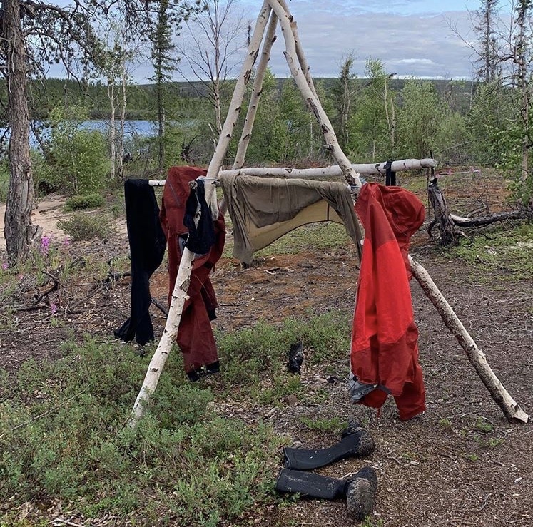
Just as I was getting ready to do something like this I came around the corner and spotted a sand bank. These are rare in this part of the Cochrane but are great indicators that there may be a flat and dry area up above the bank.It turns out that other people have thought the same thing. This is a native camp that is obviously been used many times. I have a great spot for the Hilleberg tent and Iʼm using the drying rack to dry out some river soaked clothing.
Tomorrow with any luck I make the last native village on this route – Lac Brochet. The only problem is that I am told by satellite that there will be a very, very, very strong northwesterly wind tomorrow and the lake the town is on is very large.So even though I am probably only three hours paddle away I may have to sit tight and except being windbound tomorrow. We shall see…
July 20, 2019


This morning started out still, silent and beautiful. I was up at 5:30 am and was treated to a stellar sunrise as the mist slowly started to burn off the river.
Camp was broken down, I was fed and the boat was stuffed by 7:20 am, and I set out upriver. In theory I was only about 14 km from Lac Brochet which should be an easy 3 hours, but it fact it ended up taking more like 7 hours of hard time.
The first obstacle was a kilometer long set of rapids that I climbed on the river left side. The first half was the standard underwater willow bank climbing exercise that has now become so painfully familiar.But then halfway up the bank became so steep that I could no longer wade without getting swept away.
Many, many bad words later I had all my stuff up on the bank where I bushcrashed though the dense riparian forest with uneven footing with one load, and then said f*** it and just dragged the partially loaded boat through the undergrowth. Back to the river a few hundred yards later for some more wading and tracking along the overgrown bank to get to the top.
By this point I had been underway for 3 hours and made the mistake of looking at my GPS. Apparently I was still only one kilometer from the camp where I had started. At that rate this 1000 mile trip would take 400 days assuming I put in a full 12 hours every day and took no rest days ever.
Now in truth the river was bent like a question mark at this point so I had actually travelled about 3 km as the river runs, but still, mucking about in the water, mud and brush for 2 1/2 hours had certainly slowed me down.
The next set of rapids, the final real set before the lake, were easier.
The river left (northern) bank at least had lots of riffles and exposed boulders which made wading and tracking much easier. It was less sketchy than the previous set but I was still very happy to be at the top. The next obstacle was the lake itself. The town of Lac Brochet lay to the northwest and thatʼs exactly where the wind was roaring in from. It took hours of persistent paddling, resting occasionally in the lee of some islands, to get to the town.
July 21, 2019
Lac Brochet is a lot bigger than I remember it from more than 20 years ago (my last big solo trip from Jasper Alberta to Churchill Manitoba also came through this section of the Cochrane River, albeit downstream instead of upstream). The first stop was at the Northern store which was closing soon to get some food supplies although I also gave in and got some extra bug dope (up until this point Iʼve mostly been relying on clothing for protection from the black flies and mosquitoes.
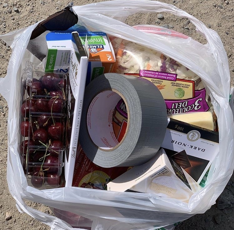
This store had a really good selection for being in such an isolated community, so my afternoon nutrition consisted of a pint of Ben and Jerryʼs Cherry Garcia ice cream and a pound of fresh Okanagan Cherries. This is the last town, hamlet or reservation Iʼll be passing until the end of the trip so it was time to splurge! There was a small resupply shipment (including a replacement paddle) sent to the RCMP depot here but when I find the town Constable he says he hasnʼt received anything. The post office is closed until Monday so unless Iʼm windbound tomorrow I will paddle on and have that stuff returned to sender.
Currently camped on a very small island which is basically just a pile of boulders with a few trees and bushes growing in the cracks. I did manage to find one flat area on the island, a small meadow-like thing covered with bunchberry flowers just barely big enough for the tent. Iʼll rest here tonight and deal with tomorrowʼs problems tomorrow.
July 22, 2019
Day 21: up at 5:30 and on the water by 6:20 to beat the wind on Lac Brochet. Nice idea, but even though it was early I got hit by the worst headwinds of the day. After 4 hours of paddling directly into the wind I was dismayed to see I had only gone 8 km (thatʼs half walking speed). The paddling and wading would continue for 13 hours in total, a new record for the trip, gaining 38 km as the fish swims. I am completely, utterly done for the day!
The wind diminished a bit and I hit it hard. After 12 hours on the water I was exhausted and was taking short one to two minute breathers (ok, I was lying straight back on my gear like Iʼd been shot) every 10 to 15 minutes. But now there was Whitespruce rapids. Both sides of the rapid had nice bouldery sections where tracking and wading was a joy, and those dreaded overhanging willow sections. Always with the willows on this trip!
I went up the western side of the river and found several new ways to make progress through the willows. First I would tie up the boat and then go ahead to clear out some of the worst sections. To make it around one bush/ log jam took about 10 minutes before all the wood had been detangled, branches broken, and thrown in the river, but it made that section much easier to do. The second innovation was going ahead sometimes and rigging a line to float back down in the water. The final discovery was that in addition to pushing the branches up and ducking my head down to water level to get past the bushes I could also pull all the branches down into the water and then pin them there with bow of the canoe. Then I would get on top of the branches, scramble ahead, and repeat the process. Fun times.
Interestingly enough I am camped at the exact same place where I was on July 3rd, 1993 (or 9,514 days ago!). On that trip I was coming down the Cochrane, towards the headwaters of the Seal River. Iʼm pleased to note that I covered the same distance today at age 50 that I did back then at age 23. Of course it took me 13 hours of intense labor whereas back then I was probably taking it easy, but whatever. 23-year-old Stephan: suck it!
The campsite tonight is clearly quite heavily used by natives and/or fly in fisherman. I know from experience the bears often like to visit the sites because some people get sloppy and leave food or fish guts behind. I definitely set up the bear alarm tonight!
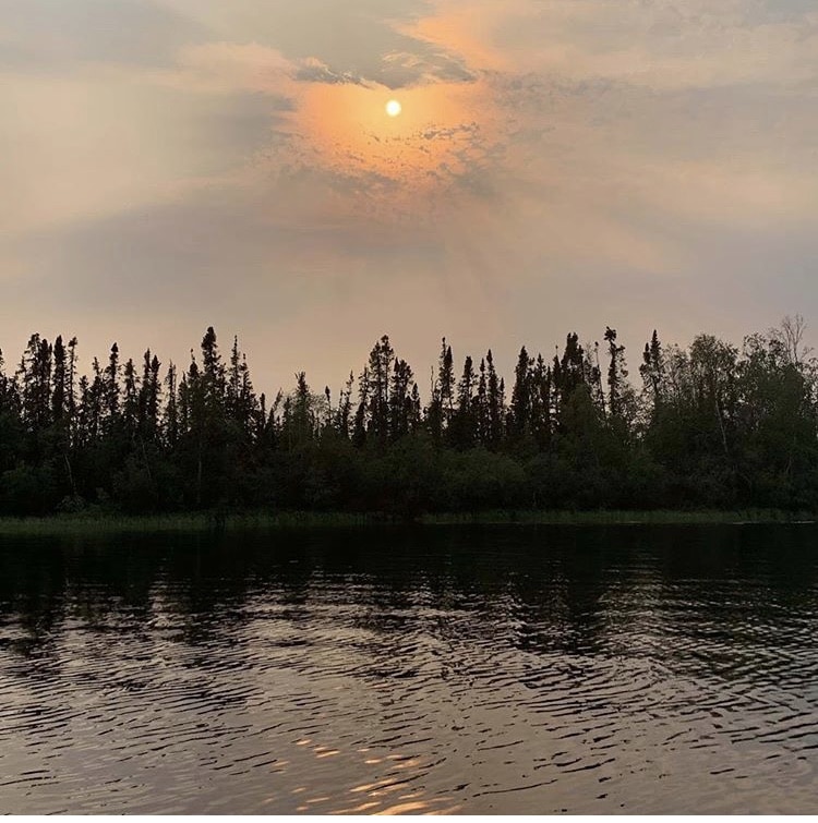
There has been a vast haze on the western horizon all day, and at sunset it turned the sun Halloween pumpkin orange. The faint smell of smoke is everywhere. Iʼm wondering if there are big fires in British Columbia or in Alberta that are now thought to be the new normal in the warming climates of those provinces.
Iʼve been on the trip now for 21 days. The vast majority of those days have been spent plodding across large lakes and climbing upstream. Iʼm totally ready for a change of scenery. Fortunately in maybe 2 days, weather permitting, Iʼll get to the esker complex which divides the Cochrane River watershed from the headwaters of the Thlewiaza River. Iʼm guessing itʼll then take another couple of days of portaging and mucking around until that river gets large enough to paddle but then I start getting some downstream action at long last!!
July 23, 2019

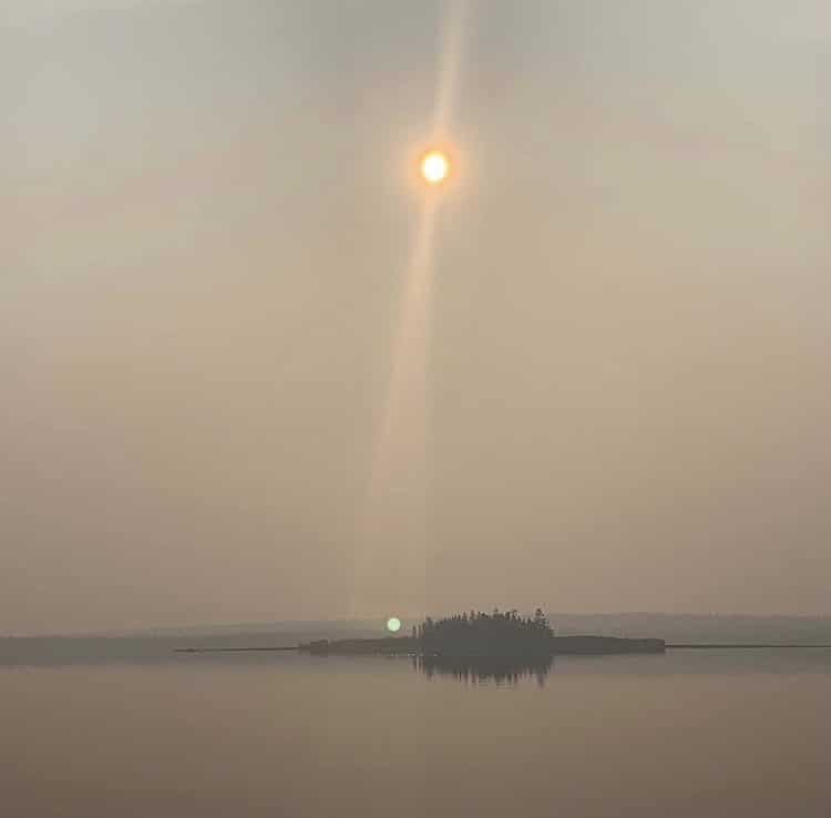
Fire… The smell of smoke is thick in the air, visibility is down to a single kilometer, and I am using map, compass and GPS to navigate across even small lakes to pick the right direction into the haze. Thereʼs a big fire ahead of me somewhere to the northwest, possibly less than 10 km away. Iʼm heading directly towards it because by tonight my route hooks hard 90 degrees to the northeast and I should be able to get off the X. So itʼs a race for the hook point, trying to get there before the fire does. Will update…
Lots and lots of upriver and upwind travel today. Had to do a lot of this: dragging a boat upriver when the current was too swift to paddle. No problem, but worrying when youʼre in a race against time. At least the shrubbery today was Myrica Gale (sweetgale?) which has a delicious scent when youʼre in the middle of it and, more importantly, doesnʼt protrude out into the river as far as willows. So the wading was a lot easier than previous today, though copious.
Speaking of waiting, I found a beautiful high water sneak route joining Belfie and Misty Lakes. About 1 km west of the rapids connecting the two lakes there is a deep inlet that almost cuts the isthmus in two on the map. When the water is high it actually does cut it in two, and wading up that saved me 2 km of paddling and a likely hard session upriver in the rapids.
At the “hook”, finally! As I talked about in a previous post, I was racing for this point, hoping to get here before the wildfires did. The route today zigzaged east and west as it went generally north. Every time I went further east the smoke got less and every time I went further west the smoke got worse, my eyes started burning, and a wall of gray rose up in front of me.
Also the smoke got worse when the wind came from the northwest instead of the north. The hook is the western most part of the Cochrane River route that I will be doing. As such it is closest to the fire, and I had to get here before I could start going away from the fire. So I was very glad to get here before the fire did, which is probably only a matter of a day or so unless there is a ton of rain.
At the hook it looked like Sauron was trying to turn this land of blue blue skies and green green trees into Mordor. Smoke and darkness everywhere. By this point I had been on the water and in the water working hard for 12 hours, but I couldnʼt stay here. I had to get further away from the likely intersection of the river and the fire, so on I went.
The only bad thing now is that the northwest wind but had been in my face all day completely dropped off to nothing, just when I couldʼve used it as a tailwind.
Itʼs getting close to sunset time but this is still way too close to the fire. Onward, onward…
A stunning lichen-covered campsite far away from the fire and on the safe side of the river. 13 1/2 hours on and in the water, paddling against an incessant headwind and wading up long stretches of river too swift to paddle. Something like 38 km covered today. I am done!
July 24, 2019
A late 7:15 wakeup and 9:00 am start on the water today, but I was pretty destroyed from the back to back marathons and the race against fire of the last two days.
Spent 3 hours working my way up the last few rapids and swifts of the Cochrane River – nothing too tough – until I came to a place where an esker kissed the eastern bank of the river. My map indicated that this was the spot where a portage takes you over the watershed from the Cochrane River to the Thlewiaza River system.
I divided my gear – maybe 260 lbs of it including the boat – into 3 batches and then did the portage in 5 stages. I would carry the first load, dump it, go back for the second, dump it in the same place and go back for the third (so 15 carries in all). Doing it this way meant that I got more breaks, minimized the chances of losing my gear, and meant that I was always reasonably close to the shotgun in case I ran into a bear.
The first half of this portage was pretty diffuse at first (or maybe I just didnʼt find the right trail). It went uphill, along game trails, through bushes and open areas. I used the GPS to make sure I was on track and tried to connect the terrain I was seeing to the contour intervals on the map.
If youʼre ever going to do this portage then basically head uphill to the north and hook a hard right when the terrain starts going downhill a little bit. Also at this point there is a fairly clear trail heading east with the occasional blaze on a tree and a few logs having been removed from the trail with a saw or an axe.
From there the trail continues east but there is a split and a sharp descent to the left available that you should take because it takes you down to the southernmost tip of Lovell Lake. I was so hot and sweaty that I went directly into that muddy, deliciously refreshing water.
In the grand scheme of things this was quite a difficult portage. Maybe only 1 km in length but it took 3 1/2 hours of hard work. Totally worth it though because Lovell Lake is beautiful.

While Iʼm talking about portages I should tell you about the one out of the north end of Lovell Lake to the next small (unnamed) lake on your way. There is a very nice trail at the top end of the lake just to the right (east) of a small rush wetland. I didnʼt find it on my first carry and instead took the much harder boreal forest scenic route over the esker about 100 meters to the southwest. Definitely recommend that you spend the extra 5 minutes scouting for the nice path rather than the brute force option of creating a new portage across the esker on your own!
Just as I was finishing up this 2nd portage a massive thunderstorm that had been rumbling in the distance for an hour caught up with me. I went into speed tent pitching mode on the esker and just thrown my gear and my body inside when the storm started pounding down on my position. This curtailed my day somewhat and meant that I only travelled for 8 hours and 45 minutes today, so I suppose it makes it a rest day of sorts. Tomorrow letʼs see how many of the 4 or 5 remaining portages between here and Fort Hall Lake I can bang off because after that itʼs downstream all the way to the Bay… except for battling winds on some of the huge lakes on the way but thatʼs par for the course now!
Finally in the Thlewiaza watershed!! It took 28 years of daydreaming and 14 years of planning to get here. I first read about the Thlewiaza, Nueltin Lake and the Old Way North in 1991. At the time I was researching another trip – the Seal River – but what I learned piqued my interest and I filed it away for another day.
Then came children, which was fun and rewarding but it also made me yearn for all the things I could not do when they were young. To help keep my sanity during the “challenging” phases of parenting I would daydream about heading north again one day on my own, to Nueltin Lake and the land of little sticks.
In 2005 I actually set a date: I would do this solo trip in 2014. At this point the kids would be old enough to not forget me while I was gone.
I even bought 1:250,000 maps for the entire trip and diligently waterproofed them at night in the firehall. I only had to wait another 9 years, and in the meantime I put a few of these maps up on the wall like artwork, to study and to remind myself that the North was still there, waiting for me.
Then in 2010 life happened, specifically a divorce. Overnight my finances were gutted: I went from living in a nice apartment to a basement suite I would have been ashamed to live in as a student, and the North suddenly got a little further away. And, oh yeah, I had to have a kidney transplant.
It took 9 years to recover from that, to build the relationships needed, let the kids get older, find an amazing woman who was supportive of her man going away on a crazy adventure, and set up the systems that had to be in place for me to have a shot of going away for up to 50 days in the middle of the summer.
A critical part of that, incidentally, for anyone in similar shoes, was working towards a good enough relationship with the ex so that she would be willing to help out and take the kids for that long, and for that I am very grateful. So guys, do your absolute supreme best to be civil, polite and friendly to your ex-wife even if it feels like your skin is being flayed from your body. Things WILL get better.
So here I am, in Lovell Lake, which is the first in a series of small lakes and creeks in the Thlewiaza watershed that will eventually turn into a large, powerful river and go all the way down to Hudson Bay. Normally Iʼm all about speed of implementation. Speed of implementation and putting ideas into action QUICKLY (starting that business idea, training with that super- knowledgeable black belt, signing up with a personal trainer, asking that girl out at the coffee shop, etc) is probably the single biggest determinant of who is going to be successful in life.
Movement beats meditation every time. Rather than ruminating about a decision go and find a way that you can try it, test it, taste it; 10 minutes of firsthand experience beats days of looking at something carefully from every angle. All that being said, sometimes life puts huge bloody obstacles in your way and you have to temper your speed of implantation with patience. It took 28 years but Iʼm here now bitches! Donʼt forget your dreams.
July 25, 2019
Today there was a fun game called “find the portage”. The maps I have were done in 1985, and things have shifted a lot since then! Multiple fires for instance. And, by the way, any trails that show up on my Garmin GPS seem to also be based on that 1985 data. So it was totally possible to be in the exact right place and have zero sign of any trail.
That being said, these little lakes are really pretty when the sun is out! There are 9 portages into Fort Hall Lake where the river officially starts. Yesterday I did 2 of them. Today I did 5 more.
Number 3 was a short one on the lake after Lovell Lake. Stay north of the esker running down the middle of the lake and youʼve got a short 75 foot carry just to the right of the little wetland.
Number 4 into Smith House Lake was a beast. I searched all over for the trail and couldnʼt find it, despite being exactly where the GPS wanted me to be. I headed a bit right and went along the esker for a bit, then came down to the supposed trail location because that was a much easier, flatter walk. I was carrying a load of gear, dumping it and marking the location on the GPS, then orienteering by compass back to the previous waypoint to get more gear.
The frustrating thing is that right at the end, with about 200 m left to go, I DID find a nice trail that at least some people have been using. Not sure where it began, but the portion I found (and used) lay about 50 m southeast of the ‘officialʼ (and nonexistent) trail so I would search the southeast corner of Smith House Lake more thoroughly if I ever came through here again.
The next portage out of Smith House Lake is shown as one trail but at some point somebody wisely decided to split it into two. It now starts where shown and climbs to the top of the esker but now, instead of going south of the little ear- shaped lake it goes right down to it. Then you paddle 150 meters to the north end of that lake and have a short, very pleasant carry into the next lake.
On the map it shows a creek connecting that next lake with the next-next unnamed lake. Donʼt get your hopes up though, because unless there is a flood of biblical proportions youʼre going to be doing a short 25 m carry (portage 7) where the creek should be.
I am now camp at the start of portage 8 that leads (I hope) to Blue Lake. Then one more to go after that. Because of all those portages this is the first time this trip that I have spent 3 days working my way across a 1a50,000 topo map. The fact that the lake chain cuts across the hypotenuse of the map doesnʼt help either. Itʼs all part of the game, but I look forward to getting back to moving fast soon!
It is beginning to get really pretty here. The combination of eskers, copious sand, and getting further north means that the forest is often opening up. That makes for some amazing scenery.
Smith House Lake would have been particularly pretty if the weather had been decent.
Even in the rain I could see ridges everywhere I looked. Had I had but world enough and time (and sunshine) I would have spent the entire day hiking those ridges, looking for animal sign, native artifacts, and trying to decide on the absolutely best place to camp.
Today started out gloomy and overcast, then proceeded into a thunderstorm which tailed off into half a day of persistent rain. In the evening the sun came out and I spent several hours drying my gear and repairing clothing that had been torn by the portaging.
One thing making all that portaging more challenging is that it is the height of blackfly season. I donʼt normally use bug spray but today I relented. It mostly kept the little bastards out of my face and off my hands. At the end of the day though I saw red stains on my stomach and idly wondered how I had spilled cherry juice there.
Then I remembered that I donʼt have any cherry juice. The little bastards had somehow gotten into my shirt and chewed an entire section of my stomach up into a red bloody mass. Lesson learned! The good news is that I can kill 100 of them anytime I want; I simply wear my dark pants and run my hand on my thigh. Blackflies really, really like dark clothing, which is one reason why all arctic canoeists look the same and wear the same sand colored clothing.
I am getting to the stage now where I am wonderfully focused. My only challenge is to travel for as long as I can and as far as I can each day. I love that. I love not having distractions, conflicting priorities, and having to continuously switch tasks. I have one mission: get down the river as fast as I can without dying. That brings a certain clarity to what I should be doing at any given time: either travel or do the things that are necessary to support travel.
July 26, 2019
I said there were 9 portages in total? I lied. There are 10. The portage into Blue Lake was a long one, but it was easy to find, straight, level, and mostly across dry terrain so unimpeded by bush. It was actually a joy compared to a few of the other carries Iʼve had to do recently.
The portage out of Blue Lake was also easy to find: it climbed the esker and then hung a gentle left to skirt the southern end of a wetland and drop you off into a very pretty lake.
I thought I was done and that this was technically Fort Hall Lake at first. But a little while later came portage 10.
Labeled as a creek on the map it was actually a 20 meter carry over a slight isthmus. Or in my case, a 20 meter drag. I was so not in the mood to unpack and repack the boat at this point but I simply laid down a few logs over the stonier bits and dragged the boat fully loaded from one lake to the other. This is sacrilege to some I know, but it is an expedition so letʼs expedite!
My progress up Fort Hall and Thannout Lake (where Iʼm now camped) was heavily impeded by headwinds. I probably covered 12 to 15 km on those lakes between 2 and 7, but if the wind had been with me Iʼm sure I could have covered 15 km more!

Historic Fort Hall Lake, finally!! In the old days there used to be a for trading post here, but seeing as Iʼm short on beaver Iʼm excited by the fact there will now be some downriver current action on the Thlewiaza. I celebrated with one bar of Denman Island Toasted Hazelnut 72% dark chocolate. Donʼt tell me I donʼt know how to party!
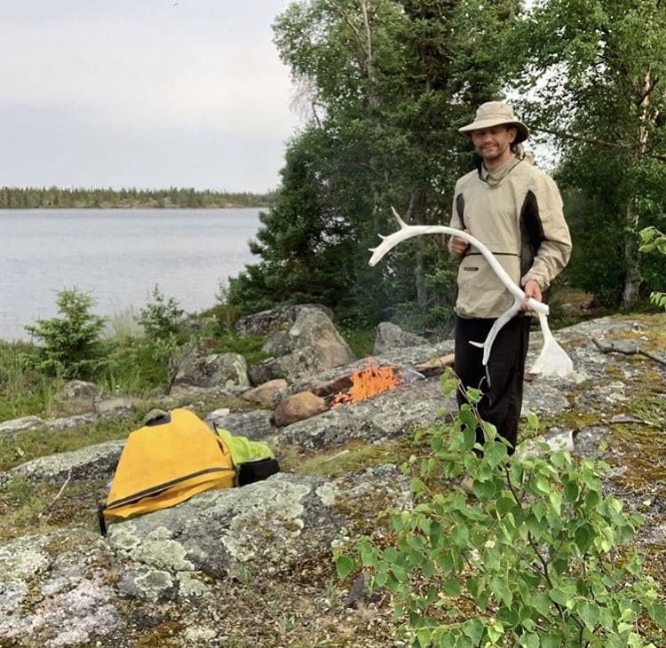
Iʼm losing track of how many Caribou antlers Iʼve seen in the last few days. It must be eight or nine. I think the Caribou are mostly on the barrenlands right now but they come down here in the winter to hide from the winds. That explains a now abandoned winter camp used for hunting that I found on Fort Hall Lake. I wonder if the natives fly in or skidoo – it would be a long sled ride at a million degrees below zero.
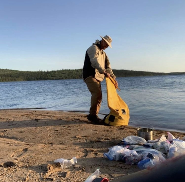
An unexpected laundry was required tonight.. When I made camp tonight on Thannout Lake I found a disaster inside one of my giant dry bags. A 1 liter olive oil container had burst, worked its way out its secondary containment, and contaminated EVERYTHING inside the bag. Weʼre talking bags of food, cooking gear, wetsuit booties, rope, fuel, and all the bags that hold those
items.
This is a disaster, not only because it is excellent quality extra-virgin olive oil, but also because the smell of food, including oil, is a huge bear attractor. Running a clean and odorless ship is one of the most important things you can do to avoid problems with bear.
I used up half my remaining soap tonight, pouring it into the yellow dry bag, adding water and soiled items, and then agitating it manually like a washing machine. Then rinse and repeat. It wasnʼt how I had planned on spending the evening but this is just the kind of stuff you have to deal with on a longer trip. Itʼs probably wise to count on spending an hour a day fixing, repairing, or mitigating your gear based problems after youʼve been on the road for a couple of weeks or more (itʼs day 25 for me).
July 27, 2019
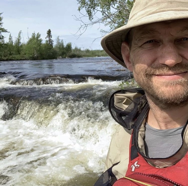
Kasmere Falls and Kasmere Portage. Itʼs never good when the river disappears over a sharp horizon line and clouds of mist waft up from below. Fortunately Kasmere Falls is clearly labeled on the map and can be heard roaring a mile away.
I thought I might pull a fast one and investigated the smaller chute on the left hand side of the island. No dice. Immediately below this ledge which would have been fun to run in a whitewater kayak and full kit came a chute from hell that I probably wouldnʼt attempt even on my best day. And the rapids below the falls looked pretty serious too, so my plans to maybe line or portage the worst bits of the whitewater came to a screeching halt.
Kasmere Falls and the rapids below drop 25 meters in 2 kilometers. Thatʼs a very hefty drop (1/14th of the total elevation between here and Hudson Bay) and no place at all for a fully loaded wilderness drop. So off to the portage I went to pay my respects to Chief Kasmere…
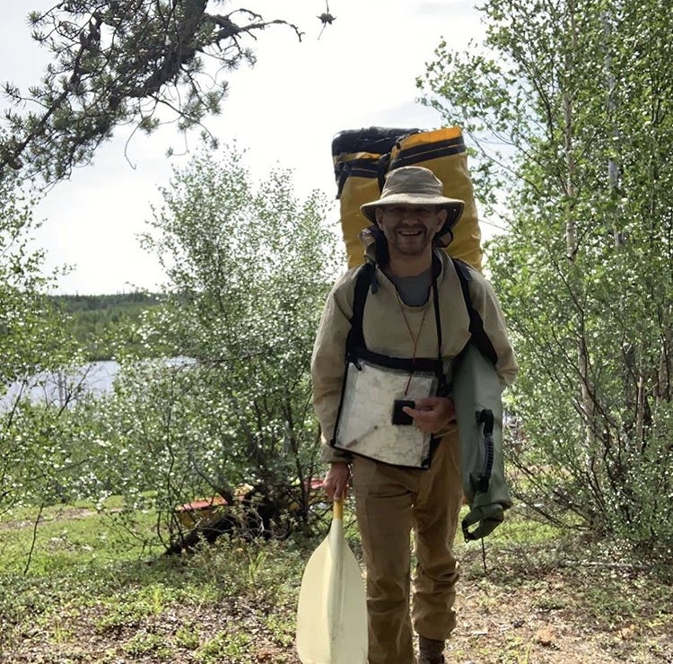
Kasmere portage is easy to find: there is a tiny little channel on the far left of the bay above the rapids that takes you too a tiny lake. The trail leads up from that lake to the esker pretty much where the map and GPS say it is.
Once you find the trail itʼs easy to follow. Basically it runs along the top of a small esker for 80% of the way north and east. Itʼs amazing how deeply rutted the trail is in places, but itʼs ancient and has been used for thousands of years to bypass the rapids.
At the far end the portage splits up a bit. You can take the high, dry, scenic and slightly longer route on the left that continues along the esker, or you can go more to the right and follow the native snowmobile route through the bushes and moss. I chose the latter because at that point I was very, very sick of carrying the canoe and could drag it over the vegetation for the last 150 meters.
This was an easy portage to find and follow but it was still a beast. Itʼs maybe 1,500 meters or 1 mile long, but while that doesnʼt seem like much in a national park with a few dayʼs worth of food itʼs a different story when you have 25 days of food, gear for arctic conditions and the need to be completely self reliant for months.
I did it in 3 carries: a giant but reasonably light load (80 lbs maybe?) first to find the way, then a heavy load of food and cooking gear (130 lbs?) and then the canoe and the last 30 lb backpack. The canoe was by far the worst and I had to rest many times: itʼs awkward, gets caught on bushes, you canʼt see, and Iʼm not a fan of the default yoke that comes with the Sea-One even though I added extra padding to it. What I wouldnʼt have given for a good deep dish yoke!
From landing my canoe at the trail head to having everything back in it at the far end took 5 hours. The portage is only 1.5 km long, but you walk that distance 5 times, 3 of which are heavily laden. Iʼm getting better at the packing for portages thing but it still takes 20-30 minutes to get things set up for the carry.
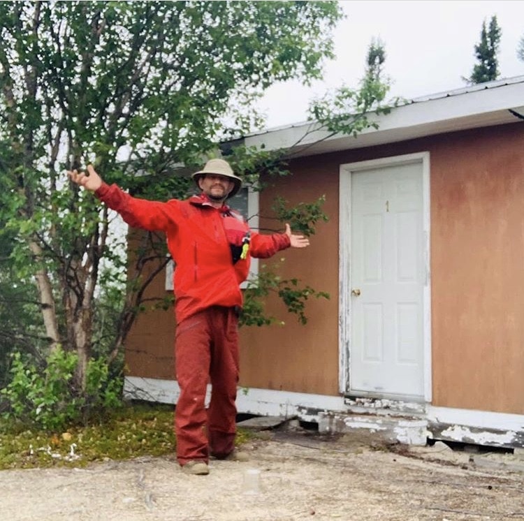
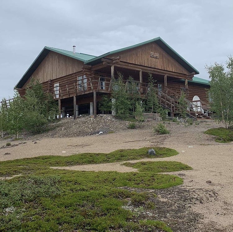
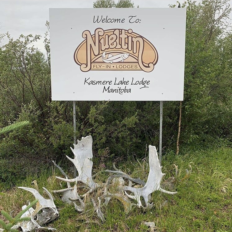
After finishing the Kasmere Portage the Thlewiaza was a delight. Some easily runnable rapids, a cow moose and calf, and a tailwind. Nothing lasts so as soon I paddled into Kasmere Lake the clouds got dark and the rain came pouring down. As I navigated in the wind and the rain I saw something that looked like a giant roof in the distance. “No way, Iʼm seeing things” I thought. Maybe Iʼm seeing things in the exposed sand of a distant esker. Back to paddling.
When next I looked I saw that it was indeed a giant building, high on a hill. Turned out itʼs the Kasmere Lake Lodge which was abandoned a few years ago. The main building was open but very musty so I opted out on staying in it.
Some of the cabins around the main lodge were pretty destroyed but cabin number one was clean, intact and bug tight. Voila! A nice dry place for the night to sort out my maps for the next stage in the journey which is the descent to Nueltin Lake!
July 28, 2019
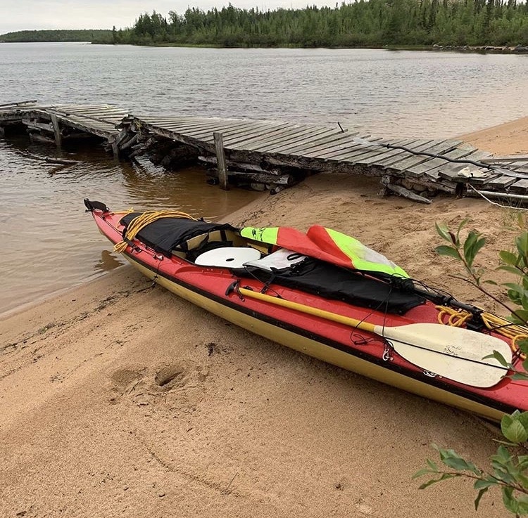
Huge news! My food and gear are finally sufficiently depleted that everything now fits belowdecks and I can attach the spray deck fore and aft if I like. That spray deck adds a significant measure of safety in big wave lakes and in rapids. As fate would have it itʼs performance in big waves was immediately tested by a stiff NNW headwind on Kasmere Lake. This lake has 4 giant arms stretching in every direction so no matter where the wind is coming from, if itʼs up youʼre going to get hit!
The first 4 1/2 hours were a huge struggle – about 14 km in total – but at 12 noon (I had been paddling since 730) I finally got back on the river and started to make some real time.
From Kasmere to Graves Lake you have one very simple rapid. Also from this point the river zigs and zags northeast and southeast I often was able to get a sail assist from the ever so persistent wind! From Graves Lake to Sucker Lake the rapids get larger and more technical but are still basically wave trains with bouldery shoulders. Ran them all no problem. But soon that would change…
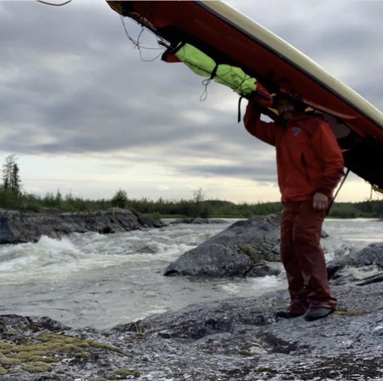
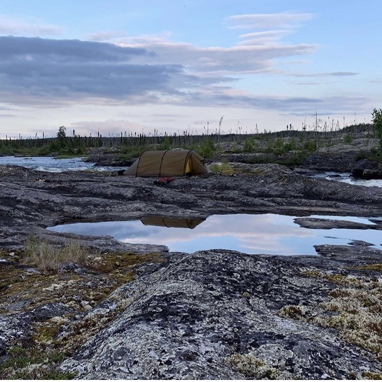
Below Sucker Lake the river changes. There is much more bedrock exposed which controls how the gradient is distributed. You go flat, flat, flat and then BOOM, major rapid. That plus the fact that the river loses 16 meters in just 4 km of rapids meant that interesting times were ahead.
The first major set of rapids I lined. The boat took a little abuse doing this but it is nothing compared to the abuse I would have endured if we had portaged through the trackless forest.
Running the next major set of rapids was out of the question. I portaged on river right over bedrock. It was late in the day by this point; I had been working continuously for 12 hours and had covered about 50km. I set up camp on the rock beside the rapids.
July 29, 2019
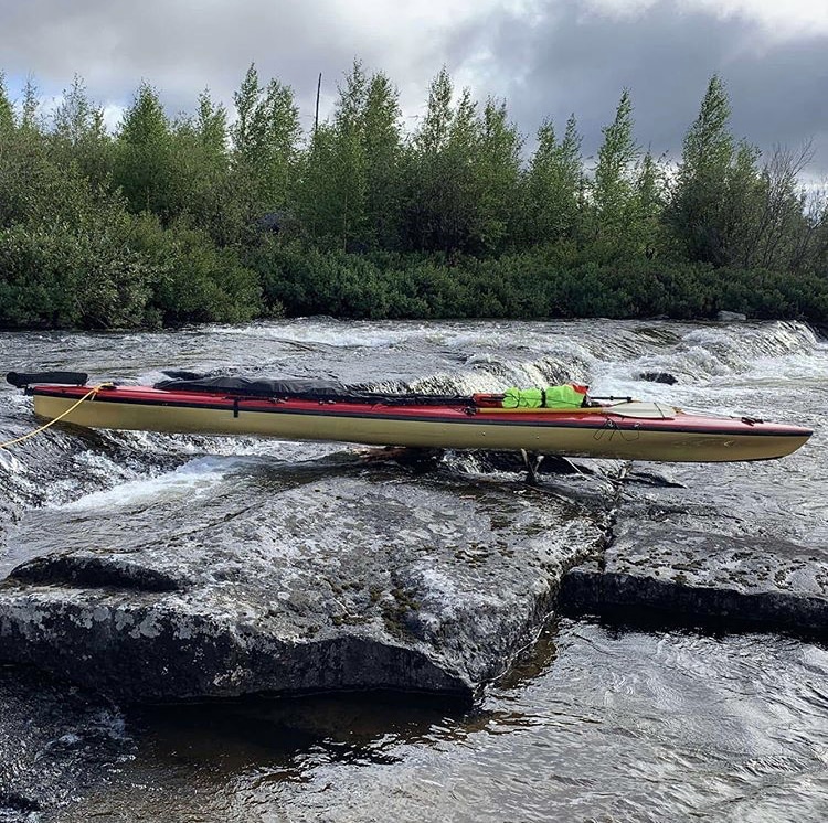
Of the 4 significant rapids between Sucker Lake and Sandy Lake I lined the first one, portaged the second, lined and hot creative with the third (built a roller system on the left hand side of the rapid to bypass a river wide ledge at its lowest volume point) and then ran the fourth. As I said yesterday, there was a ton of elevation drop between these two lakes and so that has to be expressed somehow.
Then there were headwinds, lots of headwinds. The NNW wind just blasted me anytime I was on a lake so I took the small creek that goes around the northern edge of Sandy Lake. That kept me out of the worst of the wind for an hour. Saw some nice moose there too!
Then some easy wave train rapids that I ran on the way to Downes Lake and Tuninili Lake. And then a very, very long slog up Tuninili Lake directly into the wind. Also very limited camping opportunities in this area – if you had to make camp here it would be a wet, brushy, ugly setup most likely!
Interesting how important sleep is for mindset. Two nights ago (in the abandoned cabin) I had a HORRIBLE nights sleep. Then yesterday was one of those why-am-I-even- doing-this alternating with letʼs-just-fucking-get- through-this kind of days. But last night at the rapids I slept GREAT and today itʼs a totally different mindset. You are not a special snowflake: biochemistry is mindset, personality and reality!
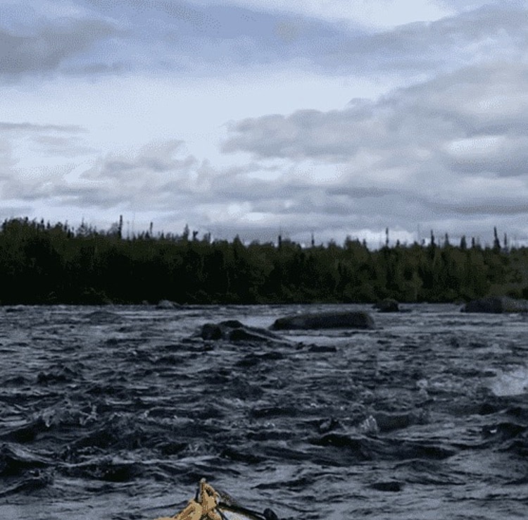
Between Tuninili and Nahill Lake youʼve got another big loss of elevation: 11 meters over 2.5 km. I was pretty sure there was a big giant monster drop or waterfall hiding in there, and the map certainly did show that there was some kind of rapids coming up.
I approached it cautiously, everything tied down in the canoe, spray deck fastened, survival gear attached to me, spare paddle at the ready, etc. I was very pleasantly surprised to find out that basically it was one long boulder garden ranging from class 1 to class 3. I ran everything on sight, scouting from my boat as I went.
For some of the bigger drops I resorted to some bonier sneak routes at the side of the river which meant that I bottomed out a couple of times and had to wade the boat for a few feet to deeper water, but managed to not have to portage or line any of it. A HUGE relief.
Todayʼs picture was snapped at the top of one of the rapids. Not the best I know, but the best I could do given that I was trying to pay attention and not die. “Nobody ever drowned on a portage”, they say. Well that might be true, but up here where the only portaging option might involve you bushcashing through dense muskeg at a rate of 5 ft/min you might well starve to death. So you need to have some white water skills, some lighting skills, and be willing to wade in hip deep water to have any chance of finishing one of these rivers.
In the evening I arrived at Nahili Lake. The wind had dropped a bit and shifted so that I now had a tail wind coming from the north west. I set off for a group of island in the middle of the lake and soon the wind picked up, and the waves increased in size as the fetch over which the wind could blow increased. I was reasonably safe in my covered canoe because my bow could submerge non- catastrophically (it did many times) and I had strong directional control with both my rudder and kayak paddle. I managed to get to the islands quite safely and found a beautiful campsite on a small gravelly beach. Had I been in a regular open canoe it would have been a very different situation though: Defcon five all the way.
July 30, 2019
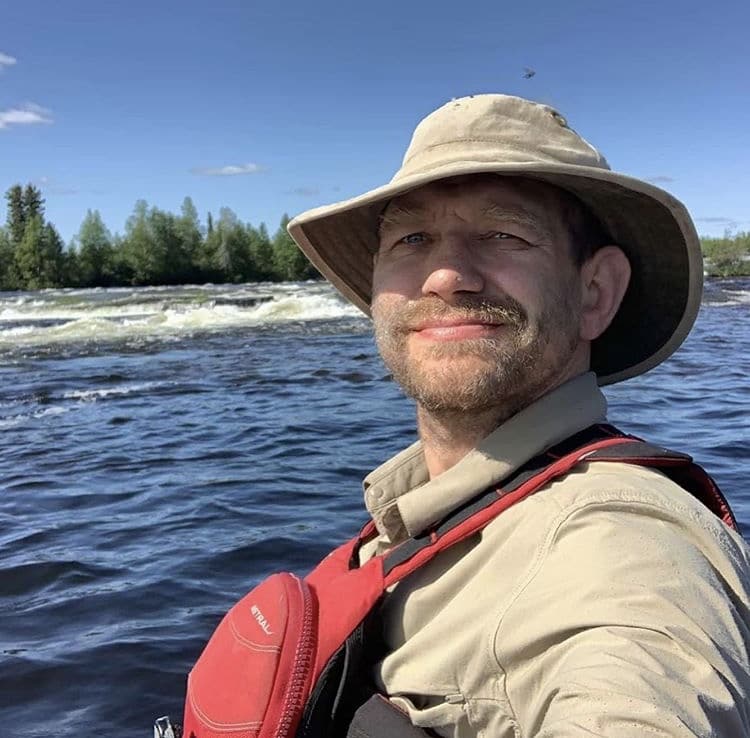
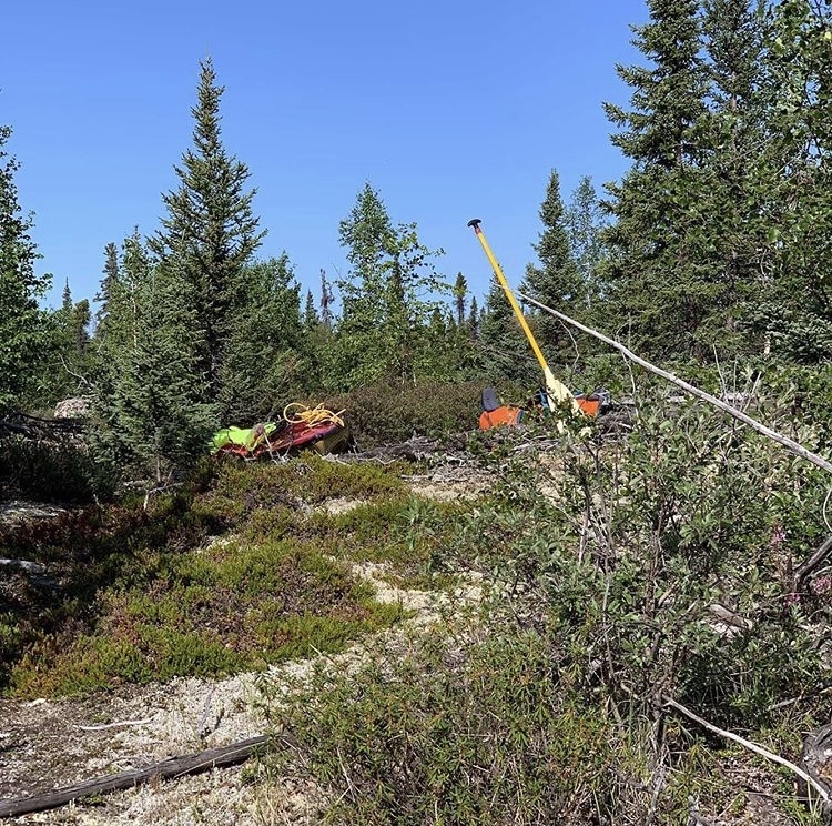
I bet I could have run it! Nahilini Falls is a series of bedrock ledges where the Thlewiaza drops 10 meters in just under a kilometer (30 feet in half a mile). While it would have been a ton of fun to screw around in this rapid in a whitewater kayak this is obviously no place for a tripping boat!
That being said, if I had absolutely no regard for my boat I think I could have slid it down the left-hand side of the rapid. I wouldʼve left a ton of hull on the rocks, but it could be done. Maybe. But much, much safer to portage!!!
The portage is in a small bay to the left just after a set of class 1 rapids and above the falls. The trail is good in places and indistinct in others. Basically pick the shortest way between the two lakes while staying on dry ground.
If you start thrashing around and spruce and thick Labrador tea then stop and find the trail again. 5 minutes of scouting will save you 30 minutes of sweating and cursing here. Itʼs also really neat to see how deep the trail is scoured into the dirt in places. I guess people have been using it for thousands of years to get around these rapids on their way up and down into the north.
You can see from the second picture why I like to have bright colored gear and why I often prop a paddle upright in a bush during a long carry. On these wilderness “trails” itʼs really easy to lose your gear while making multiple trips and shuttling in stages, so make it as easy to find as you can!!
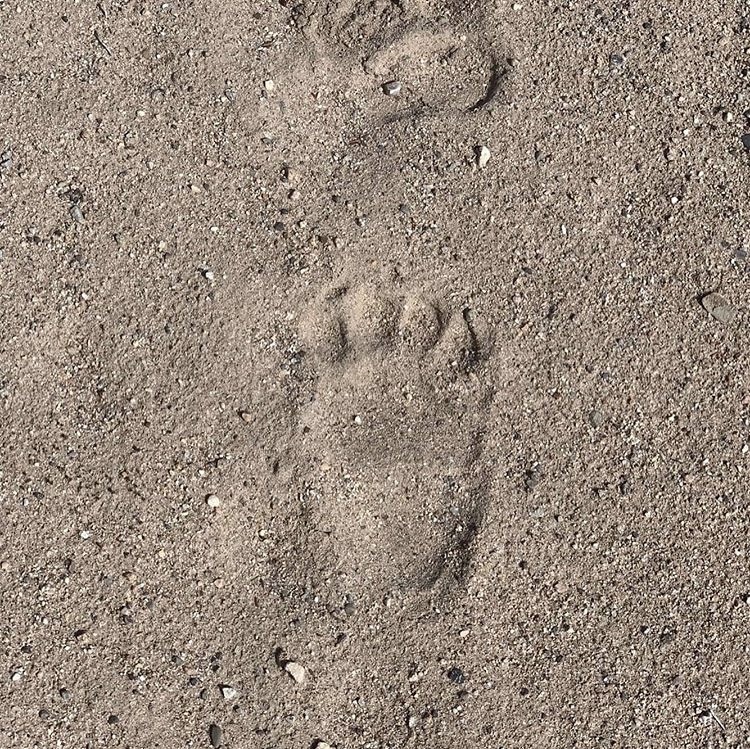
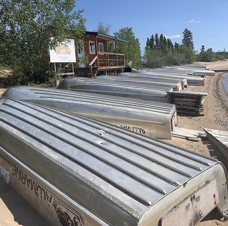
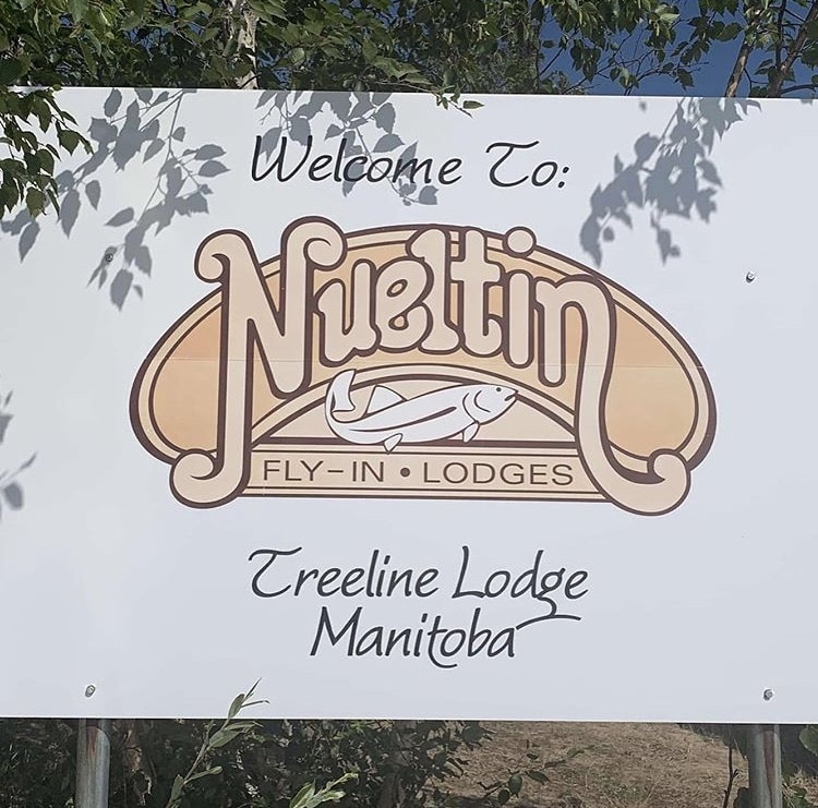
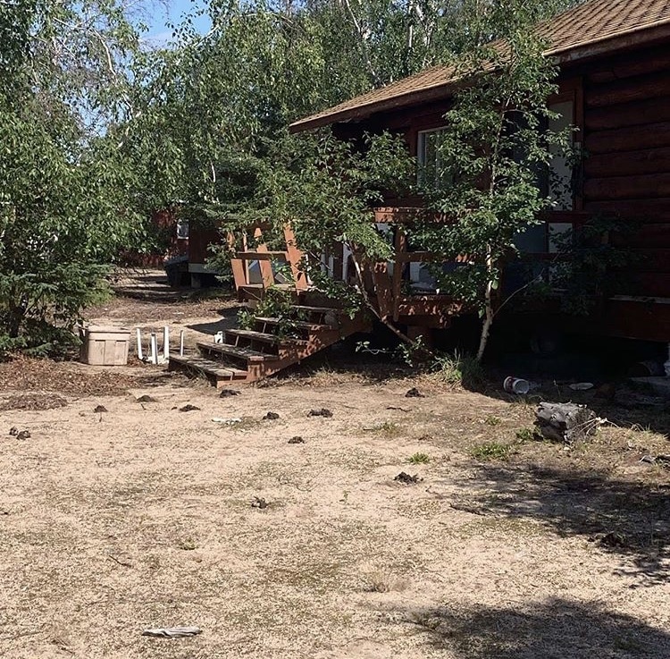
Close encounters of the bear kind… So just around the corner from Nahilini Falls I came upon another abandoned fly in fishing camp: the Treeline Lodge from Nueltin Group. I had known this lodge was somewhere on the lake but not exactly where. I wandered among the buildings, marveling at the amount of investment (structures, boats, motors, infrastructure) that had just been abandoned. Millions of dollars worth of stuff once you get it all up here.
I saw a few bear tracks but wasnʼt too alarmed. You do see those fairly regularly up here in the sand. I approached the main lodge I noticed a few things at once.
First, the bear plate (a board with hundreds of giant upward pointing nails) had been moved.
Then that the the main door had been kicked in.
Then that there were about 25 piles of bear scat all around that front door.
And then a low snort from inside the door. At that point I beat a very hasty retreat. Thereʼs a HUGE difference between coming upon a bear in the forest and cornering it in its den. Mr bear had made his den inside the main lodge building. I took a different, more direct route back to the boat and came across MANY more tracks. Some were so fresh that the sand was still moist around the claw marks.
Itʼs a good reminder that many bear problems happen around hunting camps and fly in fishing sites. The bears get used to finding fish guts, garbage, and other tasty treats in those areas. This one, apparently, also found himself a killer bachelor pad! At the Kasmere Lake Lodge I had a lovely stay in an abandoned cabin. When it comes to Treeline Lodge, however, I think Iʼll pass and if you come this way I suggest you do too!
BEAR CLOSE CALL PODCAST EPISODE: Here’s something I recorded shortly after this too-close-for-comfort bear encounter. It’s episode 227 of The Strenuous Life Podcast and it gives a still fresh in my mind account of the event.
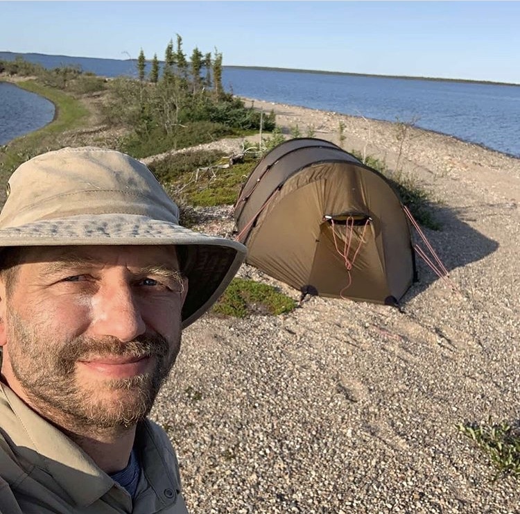
This is an extraordinarily gorgeous lake. 1,000 islands, bays and beaches with the trees getting ever shorter and widely spaced as you head north. Had pretty much perfect conditions on the lake this afternoon – a light wind from the west. Enough to give a slight sail assist to the paddling but not too strong to make conditions difficult. Kept going till 730 pm; after days and days of headwinds I had to make the most of this change of pace and get as many miles under the keel as possible.
As the B.B. King song goes, “Well things have been going wrong long enough to know when everything is just right, Iʼve been walking in the dark long enough to know when Iʼve finally seen the light, Iʼve been losing long enough to know when Iʼve finally found the one, And even a blind man can tell when heʼs walking in the sun.”
Saw a second bear (the 6th of the trip) on a sandy ridge between Sabiston and Nueltin Lake. Looked like he might have eating crow berries from the green patches between the dunes. Either the bears really like the Nueltin area or the fact that the area is a lot less vegetated makes it easier to see them. Even as recently as yesterday that same bear would still have been there but just hidden by the more abundant spruce, larch and birch trees.
It looks like thereʼs a giant fire somewhere to the southwest of the lake. I look back from time to time and especially in the afternoon it looks like a nuclear blast has gone off. I saw it earlier from the Sandy Lake area too, and triangulating I would guess itʼs 10-20 km from the southwest corner of the lake. Iʼm totally safe from this because Iʼm heading into the tundra and thereʼs no way this fire can catch up with me.
Finally I am informed by urgent satellite text that there are a couple of armed killers on the run in northern Manitoba somewhere. Again, absolutely nothing to worry about. They are many hundreds of kilometers away. If they are on foot they will never get here. Thanks for the concerned messages though!
July 31, 2019
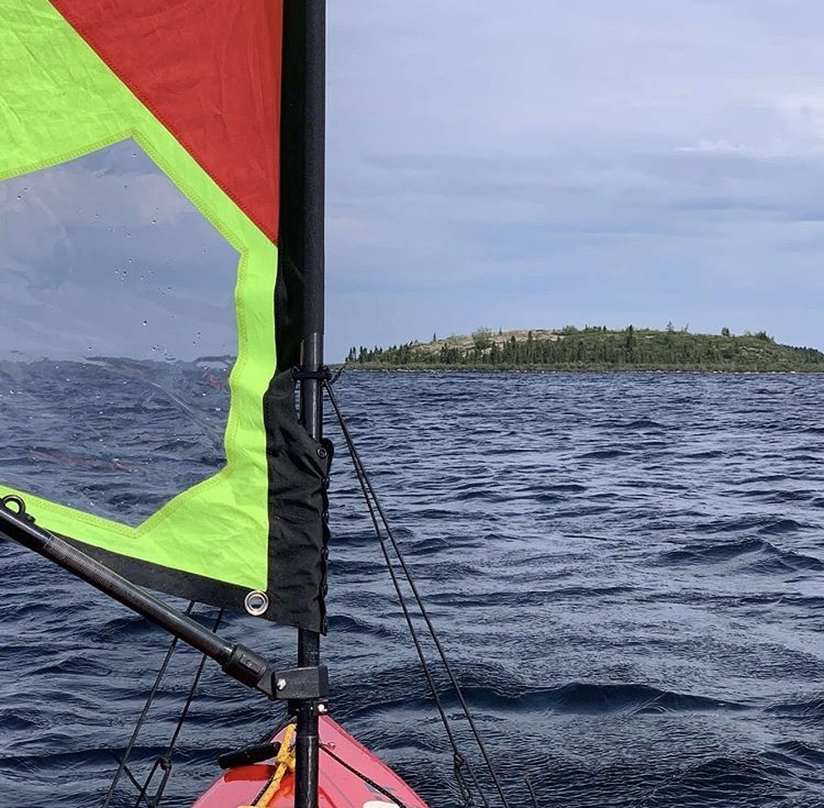
The day started with two problems. 1: my body was worn out and needed a break (more on that in a later post), and 2: there was a very strong southerly wind blowing mixed with intermittent thunderstorms that made travel across the larger open areas of the lake unsafe. Fortunately a solution was found for both problems: head north via a sheltered but slightly circuitous route through a dense tangle of islands. I would still paddle the slightly larger crossings but then be able to use the sail in the more sheltered areas and click of the miles without ticking off the body.
One thing Iʼve noticed is that sailing requires a ton of attention. Itʼs usually much more of a mental than physical game. Youʼre forever monitoring the wind, the waves, the angles of sail and boat, and whether youʼre about to get in over your head. Also in a boat without a keel a sudden gust of wind can tip you over almost instantly, so you have to continuously monitor for that, be ready to brace, scull, and kill all power to the sail.
A side effect of sailing is that navigating becomes trickier. Thereʼs simply less bandwidth left available to make sure youʼre going exactly the right way. Thatʼs why itʼs often useful to pull into the lee behind an island and take a moment to confirm your exact position on the map.
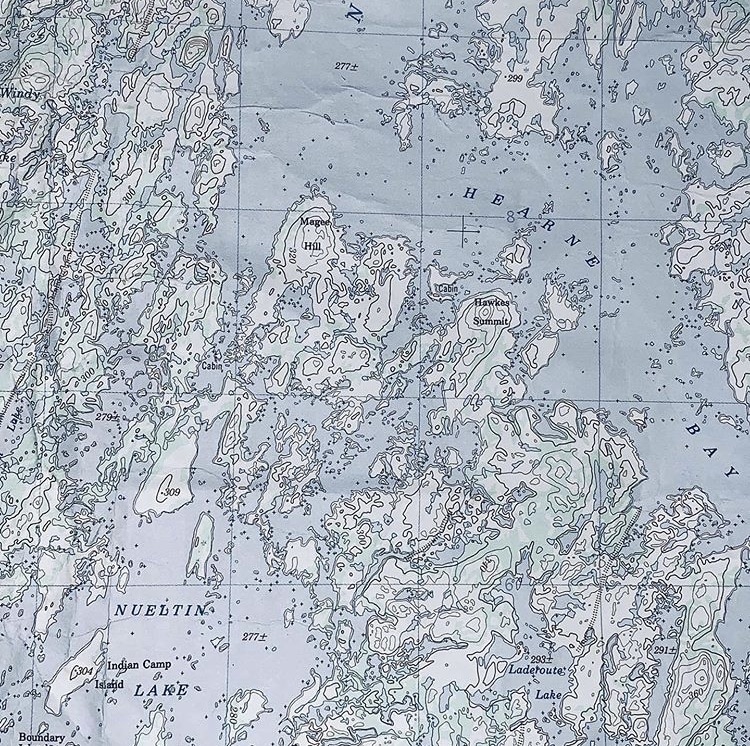
Nueltin Lake is the most complicated lake Iʼve ever been on. I pity the person trying to find their way here who doesnʼt have really good 1:50,000 maps, a compass, and the skills to use them.
Navigation is a complicated black art, absolutely necessary to be safe in the wilderness.
Half of it is using every tool you have at your disposal to pick a route and know where you are going. Your compass, your map, your GPS. The other half is using every clue nature gives you to try to disprove your current hypothesis about where you are. Itʼs a process of continual self doubt and questioning because itʼs so easy to believe what you want to believe and go the wrong way.
The clues include the size, shape, the direction of the waves. The shape of a distant hill. The presence of a patch of forest in a plain of tundra. The direction reeds are bending both above and below the water. The shape of a bay, the presence of an island. The absence of a beach. The roar of a rapid. A sandy patch on a slope. How different parts of the landscape are in shadow and in sunlight…
All of these are facts that need to be continually thrown at your assumptions about where you are to make sure youʼre in the right place and on the right track.
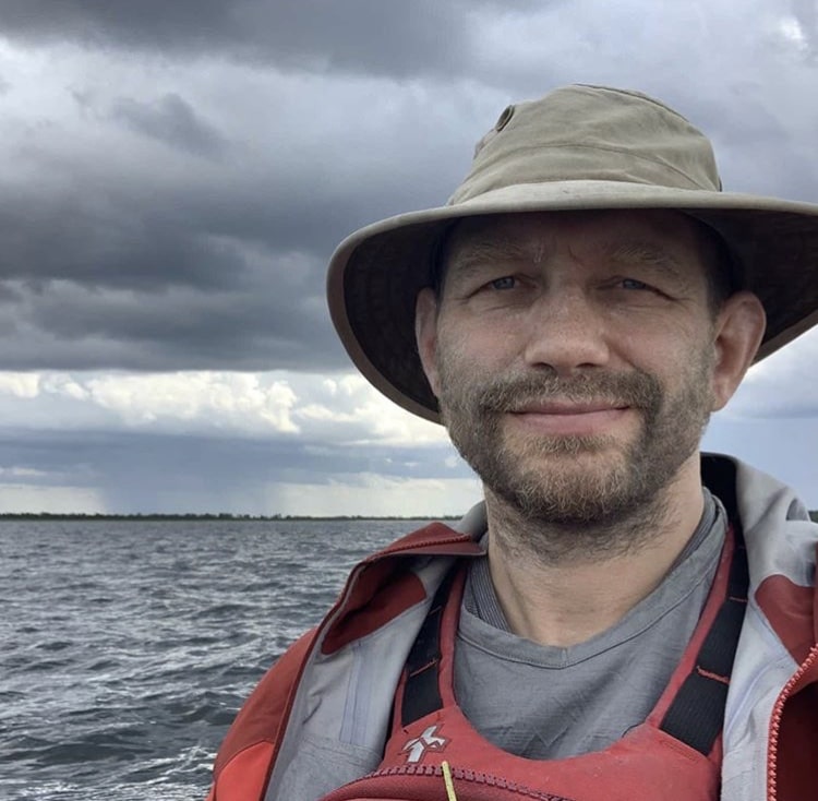
This morning I felt terrible. Overtrained, under rested, and moving like a zombie. I heard the rain falling on the tent, the waves lashing the shore, and the trees getting whipped by the wind. Whitecaps were being whipped up on the lake by a very strong southerly wind. Right, I said, a rest day, and burrowed my head under a pile of clothing to shut out the light.
The fact I immediately fell back asleep is indicative of how hard Iʼve been pushing these last weeks. Heavy physiological and endocrinological load, thatʼs for sure. Normally when Iʼm up Iʼm up, but not today. And I stayed unconscious for another 2 1/2 hours sleeping from 630 to 9 am. The second time I woke up the winter dropped somewhat, the waves were smaller, and there was now an opportunity to travel. Right, letʼs just go a few kilometers today (just the tip, just for a second, just to see how it feels…).
9 hours of paddling and 40 to 45 km later I made camp in the Nueltin Lake Narrows area. A good day salvaged after all.
Dodged thunderstorms all day. They were thundering to my left and flashing to my right but thankfully never overhead. That, plus the smell of smoke from a distant fire down south made it seem kind of apocalyptic at times.
You donʼt want to be out on the lake during a thunderstorm. Youʼre the highest object for miles around. Paddling to shore and sitting huddled waiting for the worst of the storm to blow over sucks but is often the best option.
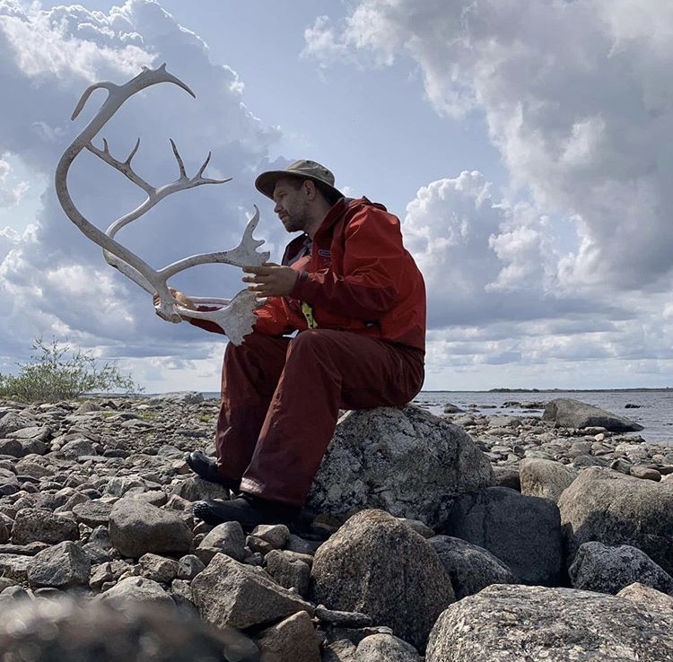
Alas poor Rudolph, I knew him well Horatio!
Despite the challenges today I got north of 60 degrees latitude, into Nunavut, and a good portion through the treeline! The tree line isnʼt some magic line where the trees suddenly stop. Itʼs a broad area, spread out over maybe 50 km, where the trees start being more sparse, then only growing in sheltered areas, and then not at all.
The tree line is also in different places in North America. For example, in Alaska, the treeline extends quite a distance north. As you come east however the treeline comes further and further south. In the Nueltin area itʼs at about 60 degrees latitude. In Ontario and Quebec itʼs even further south than that. I love seeing the different kinds of tundra appearing, mixed in with the remaining trees. Itʼs an amazing landscape, the land of little sticks.

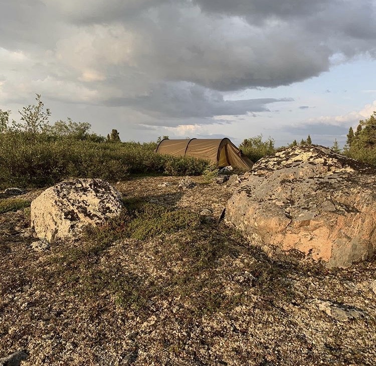
“Tell me father, is it like the land of little sticks when the ice has left the lakes? Are the great musk oxen there on hills covered with flowers? There will I see caribou everywhere I look? Are the lakes blue with summer? Is every net full of great fat whitefish? Is there room for me in this land like our land, the Barrens? Can I camp anywhere and not find someone else has camp? Can I feel the wind and be like the wind? Father, if your heaven is not all of these, leave me alone in my land, the land of little sticks.” A Dogrib Indian to an Oblate Priest.
On a July evening in 1992 I made the worst phone call of my life. I had just finished my first long solo trip: 3 weeks to go down the Missinaibi to Moosenee on James Bay and then back towards Lake Superior by way of going upstream on the Albany and Kenogami rivers. I was on an absolute high and wanted to continue all the way to Lake Superior.
I pulled into the town of Longlac, ordered a pizza, then called home to reassure my parents that I was OK. On that call I learned that my next youngest brother, Peter Johann Kesting, had died in a totally preventable motorcycle accident the week before. He had been 21, the age at which young men live like theyʼre going to live forever.
The next few years were rough. I watched my grandmother pass away at age 90, then my next youngest brother, Matthias Roland Kesting, also died in a totally preventable accident, also aged 21.
This period coincides with the time I first became aware of Nueltin Lake, linking it forever to the lives and deaths of those two brothers. Something about this lake straddling the forest and tundra, Manitoba and Nunavut, and being the juncture of so many routes and rivers makes it an icon of transitions for me. Rest easy brothers, I think you would have liked it here.
July 31, 2019
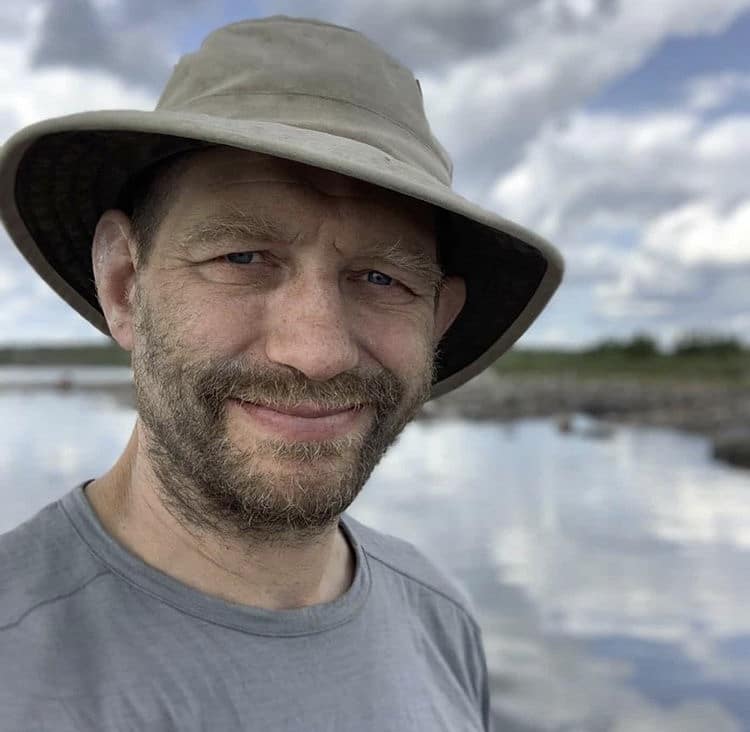
Today Nueltin Lake was a mirror: not a breeze and not a wave. At least for most of the day. I made good time, doing some bigger crossings that normally I would have been much more nervous about. By ‘biggerʼ I mean 3 to 6 km without a bailout option. Thatʼs about as big as Iʼll risk in a canoe because the weather can change so quickly up here.
In the afternoon a series of thunderstorms came in from the north. The wind was still light but I had to adjust my route, sneaking from island to island in case the lightning came close and I had to put to land.
Then in the early evening, just when the wind is supposed to be dying down – BOOM – heavy winds from zero to thirty in less than 10 minutes. This is why I fear and respect larger crossings. After fighting the wind for 20 minutes I went to shore to have dinner and see if they would drop. When they were still blowing fiercely at 730 pm I decided that enough was enough and I would have to be happy with the 35 km I had already covered.
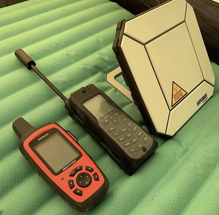
Hereʼs how I stay in partial touch out here, well beyond the range of Wi-Fi, cell coverage and even Skip the Dishes! The short answer is that itʼs all satellite based.
I use a Garmin Inreach Explorer+ as a GPS but it also has basic weather and texting function. So I use that for short mission critical texts to my support crew.
I also gave a rented Irridium sat phone that usually gets a connection of some sort.
Itʼs for short critical conversations and I think itʼll be very useful for organizing my pickup on the shore of Hudson Bay when I get there.And then I have what is called a BGAN unit. This is how I upload text and compressed photos to Google Drive for a friend then to turn into Instagram posts.
It is very slow (dial up speeds), unreliable (Iʼm right at the northern limit of where itʼs supposed to work), and data is very expensive ($3,000 for the first gigabyte). Needless to say Iʼm not streaming YouTube while Iʼm up here. Keeping all this and my two cameras charged with one solar panel and a cranky powerbank is proving to be quite the challenge…
ARTICLE AND PODCAST: Here’s a link to an article and podcast episode I recorded called “Always Be Thinking“. Nominally it’s about the difficulties of navigating across some of the biggest and most complex lakes in North America, but the larger concept of not shutting off your mind when things get difficult definitely applies to many different kinds of struggles.
August 1, 2019
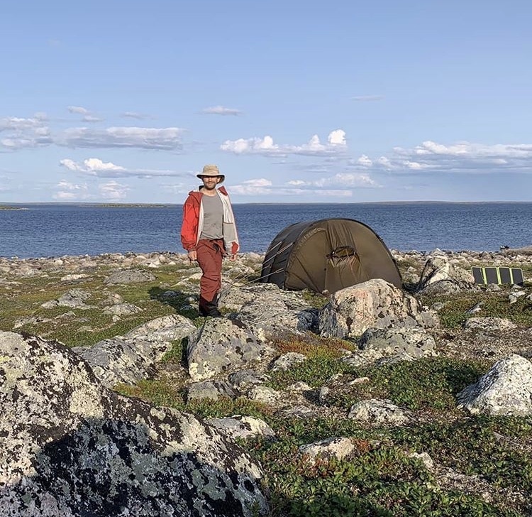
Question: I heard by sat text that lots of people have been saying I should write a book. If – and thatʼs a BIG if – I do it then whatʼs a title that would get you to buy it assuming you didnʼt already know who I am? I promise I will read all the comments when I get back to civilization.
Also this was my campsite for the night. Very pretty but hard to find a level place in amongst all the boulders. Not ideal, but thatʼs where the wind decided I was going to be staying last night.
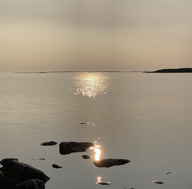
7:18 am and on the water. Conditions on Nueltin have been pretty much idyllic other than the occasional thunderstorm. No massive waves, never-ending headwinds or storms yet, all of which are a certainty on these giant northern lakes if you just wait long enough. So how many hours should you spend paddling when conditions are good? All of them.
Itʼs beginning to take its toll though. Iʼm beginning to do stuff like paddle with my eyes closed while counting to ten, then opening them briefly to make sure Iʼm still going in the right direction, and then closing them again. Also today I started feeling a burning pain in my left shoulder blade that was frighteningly reminiscent of the pain I felt when I pinched a nerve preparing for the ADCC trials a decade ago. I hope that this doesnʼt go any further.
Finally my pace on Nueltin has slowed down these last 3 days, breaks are getting more frequent, and the reasons for breaks are getting more ridiculous. “Maybe I just should re-re- recheck that map… Maybe I should reapply sunscreen, for the third time this hour… Etc.”
Overall though my physical body has actually held up pretty well on this trip, given that I started it with an injured shoulder, elbow and hip (which is why most of my preparation for this trip was cardio, not actual upper body training). Shockingly all of those injuries have gotten better, much better. Seems like all you need to do for physiotherapy is to do 20 to 30,000 paddle strokes a day, every day, without a break. Seems applicable to the population at large 
Ultimately Iʼm putting in the time. You can have all the high tech boats, bent shaft carbon fiber paddles, and fancy folding sails you want, but ultimately itʼs having your ass in the seat that gets you down the lake. Itʼs just like study time for getting your degree, or mat time for mastering BJJ. Time in activity matters.
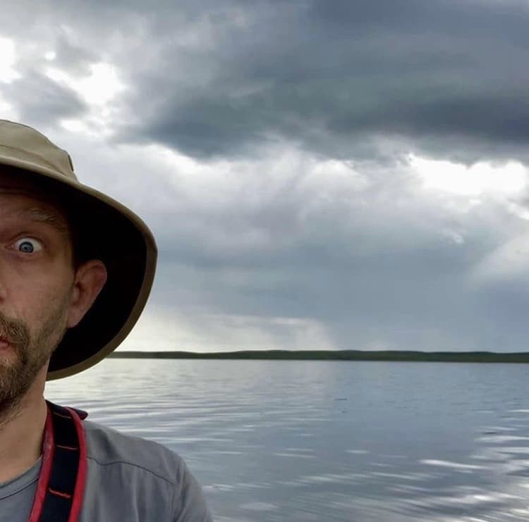
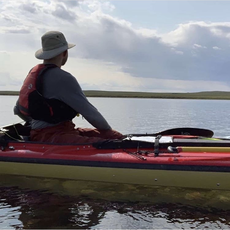
Lots of big water crossings today. Three, four, five, and even 6 km ones. I canʼt say Iʼm a big fan. First of all, itʼs somewhat boring because all the interesting stuff is on the shore. And secondly, in the middle of the water you are just so exposed, especially if there is a great big thunderhead chasing you.
As I said before though, the weather so far has been stellar. There are many stories about people getting windbound on this lake for days and days, so having to time your crossings to not get stuck in a thunderstorm seems like a small price to pay. Still managed to put in about
40 km today despite the slower pace; I just had to stay on the water longer to do it. Unless something goes sideways with the weather tomorrow I should be able to finish up stage six of the trip and start stage seven, the descent to the Bay!
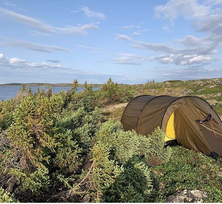
Possibly last campsite on Nueltin Lake? Unless Iʼve just jinxed it tomorrow I should be on the Thlewiaza, heading downriver with the current again!
It was a place to pitch a tent though, close to the water so I donʼt have to carry the stuff too far, and a little bit of shelter from some low spruce bushes.
The mosquitoes are fairly bad tonight. As you fall asleep you can hear the hum all around you, 1 million bugs wanting to get into the tent and suck you dry. In the past I have relied entirely on bugnets and clothing to prevent getting eaten alive, but in my old age I have resorted to the strategic use of DEET occasionally. I really only use it a couple times a day, typically applying it right before eating.
August 2, 2019
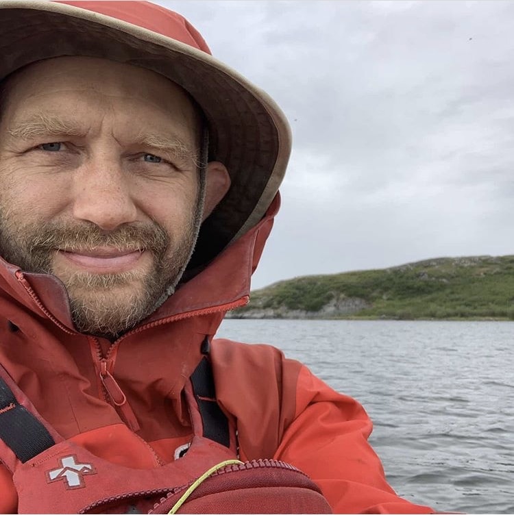
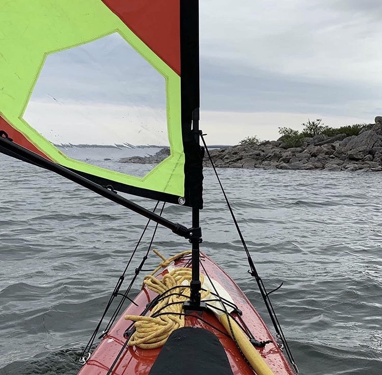
A royal send off from gods and lake monsters of Nueltin Lake as I received fine useable tailwind for most of the morning (they did have to to include gray skies and the continual threat of squalls to do it but thatʼs a trade off I will take any day).
Trying to drink in as much of the landscape as I can. Itʼs so dramatic and stark. For anyone who is never been up here I can really only compare it to the Alpine. Imagine the blasted alpine heath on a mountain just carrying on and on for miles.
It has taken 4 days to make it from the bottom to the top of the Nueltin Lake. This ends stage 6 of the trip and leads us to the final stage, number 7, the descent of the Thlewiaza to the Bay.
If youʼre going to paddle Nueltin Lake then campsites arenʼt going to be a problem.
From the south end of the lake to the narrows you have unlimited sand beaches, each prettier than the last. And from the narrows north you have tundra, so you can camp wherever you want so long as you can find a place that is reasonably level and not bedeviled by giant boulders everywhere. Oh, and a bit of protection from the wind by the topography or a clump of krummholz is nice too!
The weather has been amazing and the wind conditions couldnʼt have been better on this giant lake. I was really only able to sail on one of the four days – today – but that was way better than nothing. I figure I was making about 6 km an hour for most of the morning, three of which came from paddle and three of which came from sail.
I have to say that this 1.4 m Falcon Sail is amazing. Itʼs a rocket fuel that I can add once in a while to make the miles go much quicker. It is so quick to put up and down that you can really take advantage of even a short change in the wind. That being said itʼs also one of the most dangerous things I own. If you are sailing a canoe you need to be paying attention 110% of the time. Think of it like running white water; you need to be ready for things to go wrong at any moment. Much appreciated Nueltin, youʼre beautiful, so long and thanks for all the pics!


Pre-whitewater procedures: Every loose item tied or clipped? Spare paddle made accessible? Sail stowed? Spraydeck partially or fully fastened? Rain gear on for insulation? PFD over raincoat? All zippers closed? All entanglement hazards and impediments to a rapid bailout removed? Footpegs and seat moved forward to to balance the boat for backferrying? Lining ropes ready? Shot of bug spray? @denmanislandchocolate for energy and good luck? Well then, letʼs go!
There are three rapids marked on the 1:50,000 map between Nueltin and Seal Hole Lake. The first was easy, basically just riffles and haystacks. The second got bigger: bigger waves, more rocks, and more curling waves; I ran it on the left. The third was just a set of waves leading into a huge slow boulder garden.
Itʼs significant to note that my experience of rapids two and three is very different from other descriptions I have read. It just goes to show how white water is subjective, how rapids change radically with water levels, and how whole river beds can and are often rearranged by flooding and spring melt. No matter what you read about any white water anywhere, the moment you get there you have to read the situation for yourself and make up your own mind about what to do. These things change all the time.
For a boat with no rocker my Sea One handles quite well in the waves. Since the water isnʼt typically very shallow I am leaving the rudder down most of the time which is a big change to how I am used to running rapids. Iʼm still getting used to it but it really does help turn the boat.
One thing Iʼm NOT a fan of is the design of this spraydeck. It uses a suspender system to keep the deck up around your waist. I think that is insane. I donʼt like the entanglement potential of the suspenders – if your boat tips you want to eject, not struggle upside down in rapids trying to unclip fasteners. I much prefer the easy to unfasten system proposed by Cliff Jacobson in his Canoeing Wild Rivers book or the open turret style system thatʼs part of the Black Feather spray decks. I own and have used both of those that have no problem with those designs.
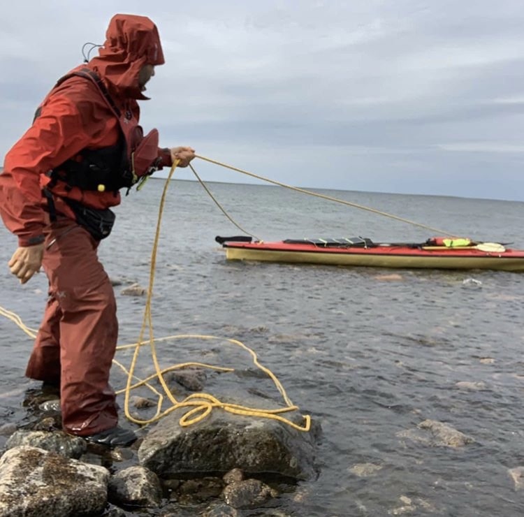
This is Seal Hole Lake, the first significant lake after Nueltin. It is a beautiful lake with some very dramatic landscape features, but why am I tracking my boat with ropes instead of paddling it? Well, it was way easier to get to a potential campsite by walking and dragging my boat in the water than it was to paddle it against the wind. After amazing wind conditions on Nueltin things then came to a screeching halt. Crazy powerful 40 to 50 km/hr headwinds came up over the course of an hour.
I had been going since 8 AM and was brought to a halt at 4:30 PM. My visions of making this a 50 or 60 km day died in the wind. I did make a solid 40 though which is still respectable. I camped early and had lots of time to document the day. I intend to get up at first light to try and beat the wind. Anyhow, Iʼm still ecstatic about being here and really looking forward to seeing the rest of this river and this countryside.
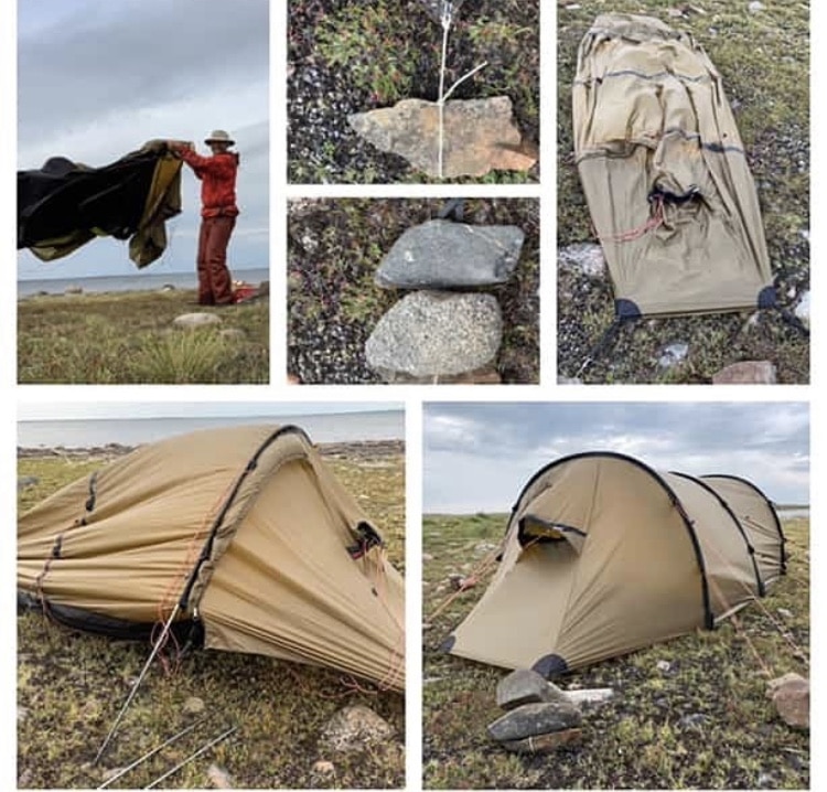
How do you pitch a tunnel tent in 40 km/hr winds when the ground is too rocky for tent pegs?
1. Gather rocks,lots of rocks. Preferably jagged and oblong rocks, not round ones.
2. Tie down your main corners to a nice oblong rock
3. Pin that rock down using a ton of other, bigger rocks
4. Do this for all 4 corners,
5. Only now insert your tent poles
5. Repeat steps 2 and 3 for every single guy line and add way more weight than you think youʼll need. The wind could always shift or get much stronger.
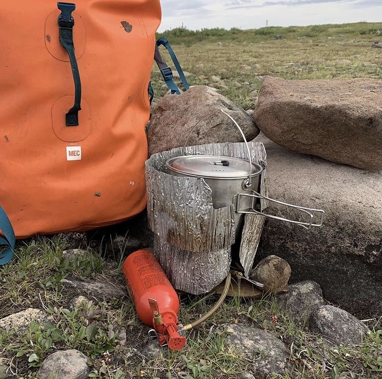
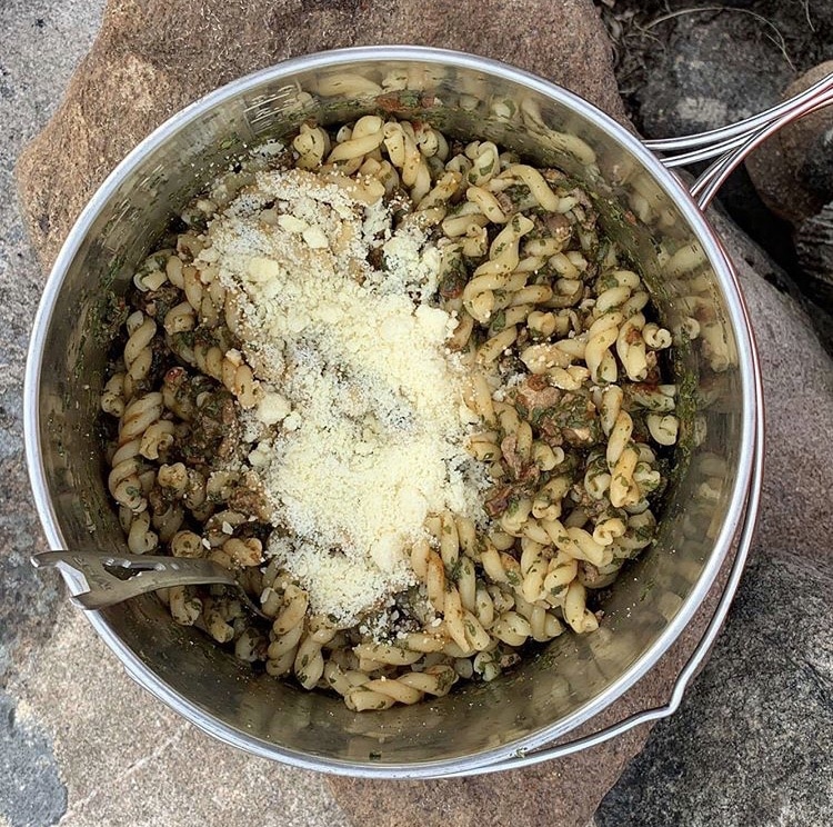
How do you cook in 40 km an hour winds? Well first you use the windscreen for your stove. And then you use rocks and backpacks to build the wind screen for your windscreen. And then, if you have one, use an extra windscreen around your part to help retain the heat. Do all that and youʼll be eating homemade Rotundifolia Bolognesca con Fughetti Seccado et Prima de Tutti Verde con queso de Villagio Parmesina (pasta, ground beef, mushrooms, tomato sauce and Parmesan) in no time.
August 3, 2019
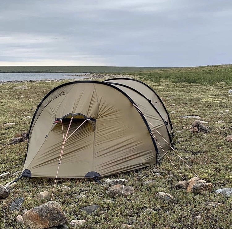
Day 34 and completely windbound. The wind is roaring in from the south which makes travel to the south, the direction I have to go on the lake, difficult. Impossible really. And just to make things better I think I can hear some distant thunder moving in. Scratch that – it just turned to reasonably local thunder and lightening complete with rain. Might as well get all the bad weather over with at once!
On the plus side it does leave a lot of time to catch up on sleep and a little bit of time to explore the countryside. Iʼve found lots of fresh signs of caribou, which is exciting because maybe theyʼll show up in person soon. Whether that happens all depends on their migration route overlapping with my own travels. Caribou are such magnificent beasts and are the animal that allowed the local Dene and Inuit to survive. Theyʼre like the plains buffalo of the arctic; a migratory herd animal with entire human cultures built around them.
Alsoin the last 18 hours Iʼve seen only 3 mosquitos, which is about a 10,000 fold reduction from what I would normally expect. I guess the little bastards are clinging to their willow branches for dear life and arenʼt taking to the air at all with such a wind.
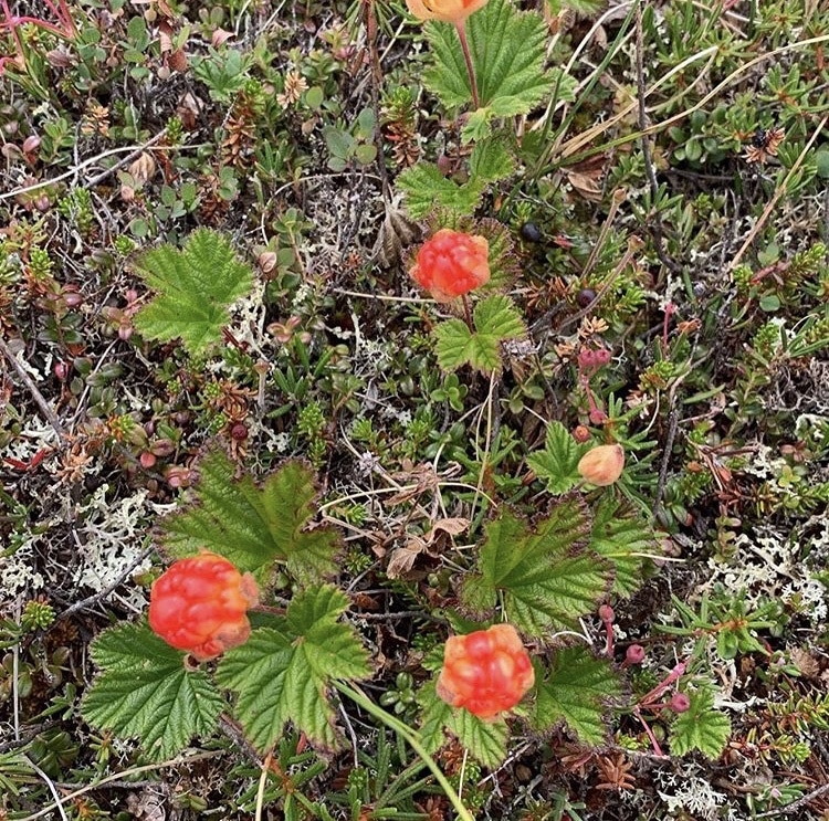
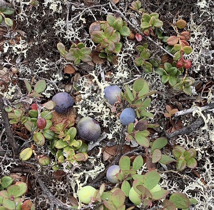
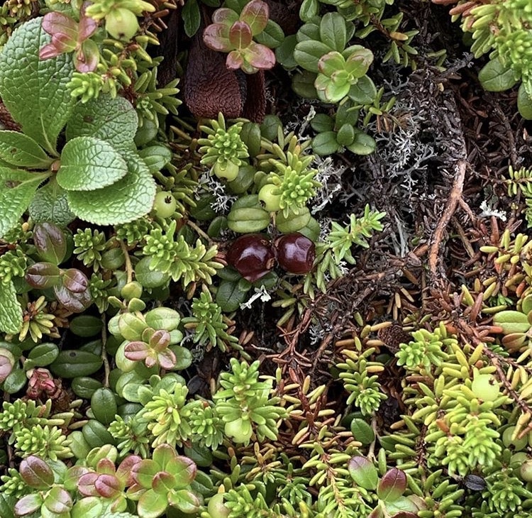
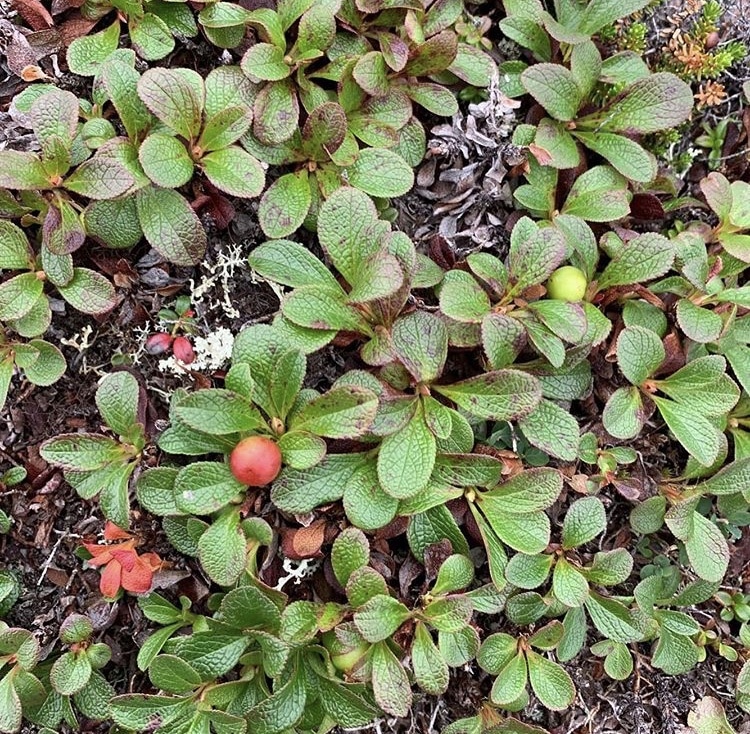
In the last few days Iʼve really noticed how many of the arctic berries are on the cusp of being ripe. Iʼve found cloudberries, blueberries, crowberries and bear berries.
That is an upside of the crazy bug situation. For each mosquito or blackfly there is also a berry to be eaten out there. Itʼs hard to believe that the barren lands grizzly can subsist on these tiny berries nestled in so close to the ground. Which is, I guess, why he supplements his diet with the occasional errant canoeist.
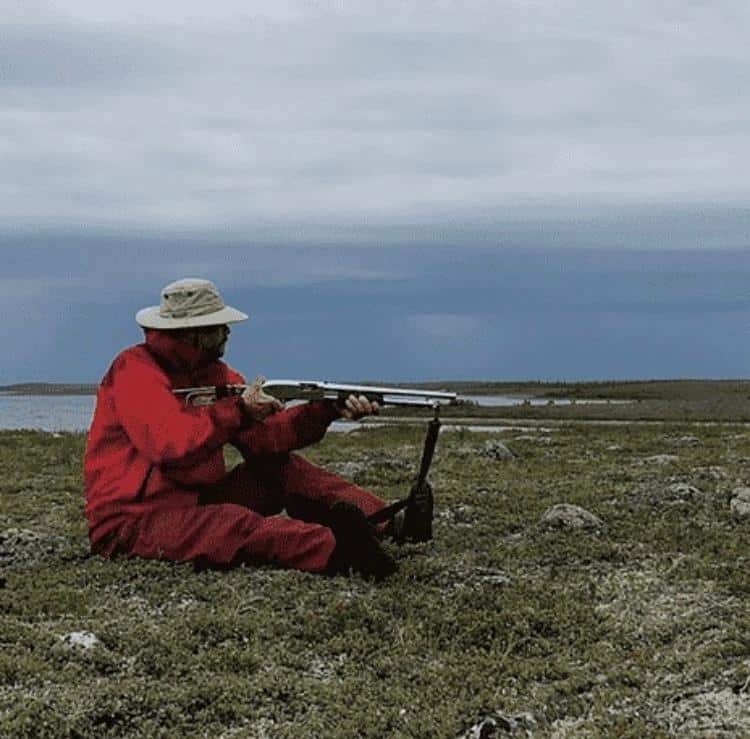
There are grizzly here but more to the point is the fact that Iʼm heading towards Hudson Bay, land of the polar bear with its entirely carnivorous diet. Plus itʼs not unheard of for polar bears to trek inland quite a long distance in search of food, especially now that itʼs harder for them to hunt seal on the winter ice because there is less winter ice. So bears are on my mind and full precautions are in effect.
Being windbound allowed me to get in some target, reloading and dud shell handling practice. I did it both standing and seated, the latter makes sense given that the most likely place to encounter a bear is when in your tent with no ability to stand.
The timing for this practice was fortunate as right afterwards the mother of all rainstorms moved in and absolutely blasted my camp. Feeling very, very glad that Iʼm in such a good tent that stays upright in the wind and keeps the water on the wet side.
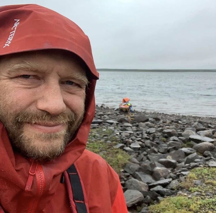
Saturday August 3rd. The wind finally started to drop a tiny bit around 4 pm so I packed up everything inside the tent and crammed down a hurried dinner. At 5 pm the wind was finally low enough to allow travel so I dropped the tent, packed the boat, and set off. I still had to fight my way across the lake mind you, but at least slow forward progress was possible again.
Near the outlet of Seal Hole Lake thereʼs an orange cabin that looks good from afar but when you get closer you can see that itʼs best days are behind it. The beach would be a nice place to camp though.
The rapids at the outflow are relatively easy – they start as a series of swifts that then grow and grow until you end up with some pretty huge standing waves right on the middle of the river. Fortunately there are big eddies on either side of the river that you can pop into to slow down and find the smaller waves from.
The next 10 km or so has lots and lots of swifts and smaller rapids which makes for fast progress. The maps must have been made at a time of very high water though because many channels indicated on them are completely dry. The wind continued to diminish until it became a completely still evening. This was confirmed by the mosquitomometer: they were soon out in droves and able to find me even in the middle of the wider,lake like sections of the river.
Made camp at 9:15 having covered 18 km in just under 4 hours.
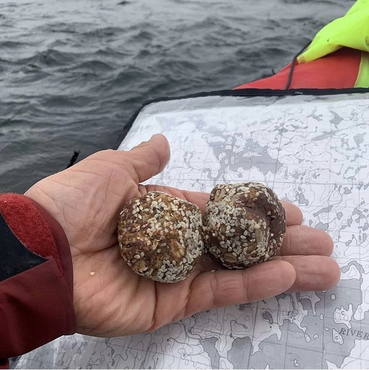
When Colin OʼBrady did his solo trek across Antarctica he had his “Colin Bars”. Well, on my solo trek across the Barren Lands Iʼve got my “Stephan Balls.”
Made mostly of almond butter, date paste and oats I eat 3 to 6 of them a day and after 34 days Iʼm not completely sick of them yet. The key to staying warm is having the right clothing but also simply putting enough calories down the hatch, and these balls serve that purpose admirably. The recipe is on my site: if you google “date almond balls grapplearts” you should find them.
August 4, 2019
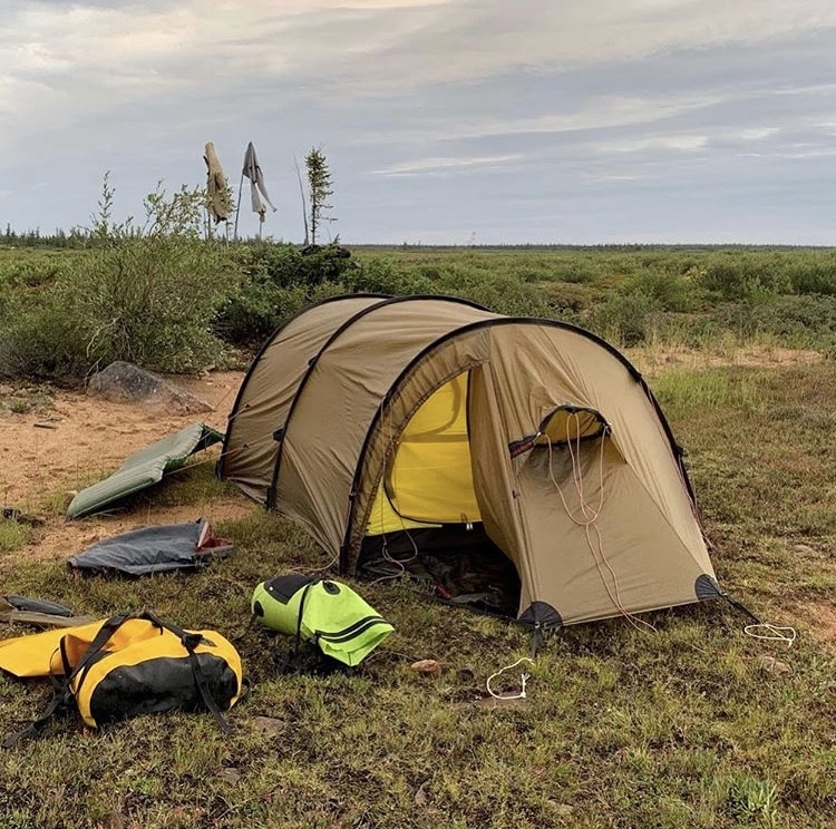
August 4th, day 35. Today was maddening. Long story short I was up at 6:30 in the morning, on the water by eight, and forced off the water just after noon. There were lots and lots of swifts and easy rapids which would have made for stellar progress if the wind had cooperated (in the 4.5 hours I did manage to bang of 25 km). One of the bigger rapids today was a set of ledges. At one point I ended up on river left where the ledges were gigantic and had to do a front ferry almost across the whole rapid to get to the runnable part. Having a rudder on your boat in situations like that really helps!
On another minor rapid I took a good amount of water in when a curling wave hit me in the side. This would have been no big deal at all if the spray deck were completely fastened up, but as Iʼve talked about before I do not like the entanglement potential of the suspender arrangement. Oh well, thatʼs what the bailer is for.
The storm hit at noon and soon I was making no progress and with the horizontal rain it wouldnʼt have been safe to be mucking about in whitewater even if I had been able to make progress on the flats.
But the way things were I wouldʼve made it careful plan to make it through the rocks in the waves and then the wind wouldʼve laughed and made a hash of my plans. Plus if I continued any longer I wouldʼve been flirting with hypothermia. I pitch the tent on a small beach where I was partially protected from the wind by a small scrap and clump of krummholz. Then I tried to nap which Iʼm not good at at the best of times. There really is a limit to how much a man can sleep.
August 5, 2019
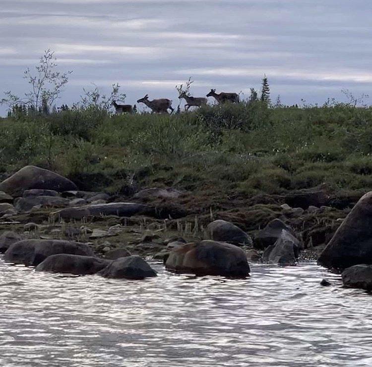
The best day of the trip so far!! When I woke up it wasnʼt raining and the wind look like it could be a tailwind. These were good things. Then I started seeing caribou. At first I saw a group of 4 swimming north across the river, and then I saw 10, and then I saw 20. By the end of the day I mustʼve seen more than 150.
All of them were heading north, and all of them were crossing the river in the shallows and then off again, running, running running. They were pretty skittish and didnʼt let me get close so a telephoto lens would have been great.
As a sidenote, I think that Portage Rapids is mislabeled on the 1\50,000 maps. I had heard a lot about these rapids: Oberholzer and McGee had done a half mile portage to avoid them, Farley Mowatt claims to have nearly drowned in them, and other groups have portaged parts and ran parts. So when I came up to where they are marked on the map I was apprehensive. But without even leaving my boat I could see a route through them: a center to left shot into a big easy eddy. No problem at all.
But Iʼm not as much as a canoe god as I think. About 10 km later came a really serious rapid that fits all the descriptions. It splits around an island and has a series of huge ledges. I went down the left side of the right channel and lined the worst parts including some 3-4 foot sheer drops barely lubricated by water. I swear that one of the appeals of lining is that you canʼt hear the damage being done to the bottom of your boat!
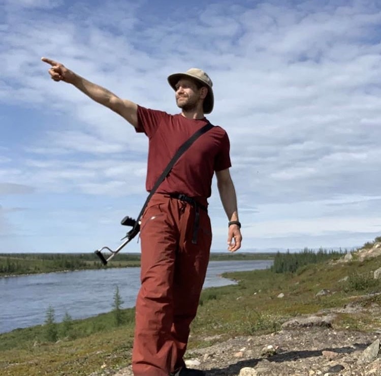
Hudson Bay thataway!! The day just got better and better. The sky turned blue and for some reason there were zero bugs out. Having started the day at 630 am and paddling since 8 am I took an early dinner break at 4 to take advantage of a beautiful location on an esker.
While food soaked I went for a walk, ate blueberries, found an old abandoned bear den under some bushes near the top of the esker, and was able to scout the river for miles ahead.
The sun, the warmth, the colors, the endless rapids, the caribou… This is one of those days that I want to burn into my brain to remember until the day I die!
Pretty nice view with which to end the perfect day, no? I covered 70 km on the river today, or 50 as the bird flies. That came from 12 hours of paddling being helped by both the current and tailwinds. I think the rain is back tomorrow but I donʼt care. This is my dream and Iʼm living it. Whatʼs yours?
August 6, 2019
Well, now we know the bear alarm works… It took a long time to get camp set up last night so it wasnʼt till 1130 pm that I finally closed my eyes. I was dozing when I thought I heard hooves – clippity clop, clippity clop. No, Iʼm sure those are hooves. A galloping horse? No, canʼt be, has to be a caribou…Which is when the crazy caribou running down the beach at full speed right ran within 10 feet of my tent, hit the bear alarm tripwire, set off the siren, and then took off even faster down the beach to God knows where.
Soon the only sound was the bear alarm going off and the thrum of mosquitoes outside, waiting for me to go out into the night and try to reset the whole thing from scratch.
Unfortunately the stampeding animal managed to tear the very strong nylon string that is used as a tripwire, so I had to repair it by headlamp in the middle of the night.
The Pack Alarm is one of those things Iʼve wanted for years. Decades ago I made a prototype but this thing is much, much better. Peace of mind in bear country (and free thrills in caribou country) for less than $100? Yes please, I’ll take two of them. My sincere thanks to hunter, firefighter and BJJ practitioner Reid Martin for turning me on to these things!
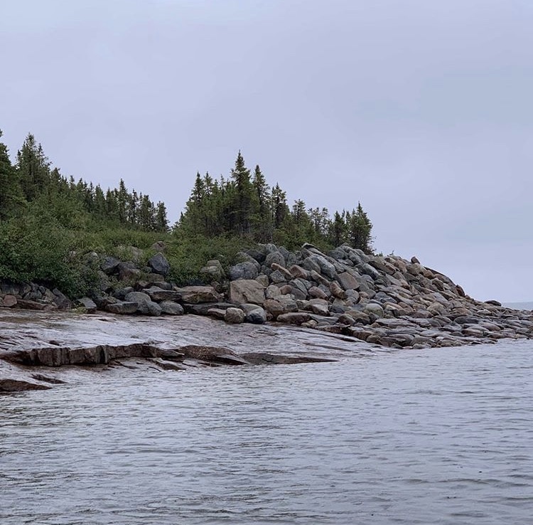
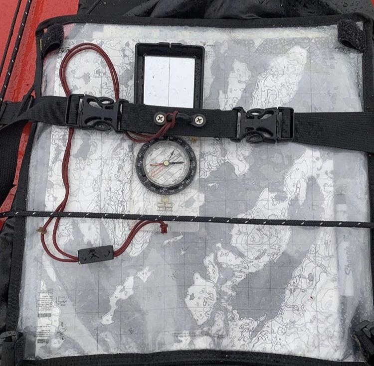
Dear Edohon, Iʼm sure youʼre a very pretty lake with your high hills and seals that have swum in all the way from the ocean. Unfortunately didnʼt get to see your best side today, what with the thick mist, persistent rain and cold north wind and all. Maybe weʼll get to know each other better some other time when youʼre in a better mood. Sandbars and rapids going into lake make it an interesting and low consequence navigation exercise.
Once youʼre in the lake you will soon come across an abandoned mining camp. Visible from afar because of its bright white and orange tents this might be a good place to try and scavenge tools and materials if youʼre ever in need and in the area. Just for your knowledge, most of the ‘treesʼ in the first picture are shorter than you are. It is the land of little sticks after all…
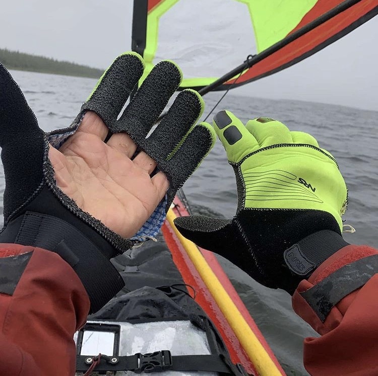
I cut out the palm of my neoprene river gloves and it has made them much better. Yes, they are a little colder now, but I can feel the paddle against my skin, I can get my fingers in and out quickly for a little finicky tasks, I donʼt have to fight the gloves to keep my hands closed, and they still keep the worst of the wind off my fingers.
Other than the gloves I was also wearing thick wool socks, calf high neoprene boots, underwear, nylon tech pants, heavy duty goretex rain pants, merino wool T shirt, medium weight fleece, heavy duty goretex raincoat, life jacket (it counts to keep you warm), and my canoeing hat crammed under my hood to form a brim. And it was still cold! I should have had on my fleece leggings because I was using the folded kayak sail to try and keep my legs warm in the bitter, bitter headwinds.
The other thing that keeps you warm in situations like this is working your ass off and continuously putting more food down the hatch. I ate a ton of food during the day, and then still had one and a half dinners when I made camp.
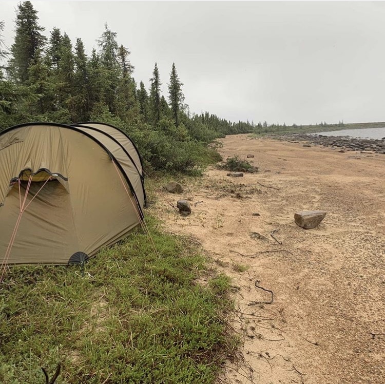
Today I started paddling at 8 oʼclock in the morning, and by 5 PM I was absolutely, completely done. Like punch drunk done.
I managed to cover 47 km today, but the last 15 km took more than five hours. Those five hours were at knock down, drag out, full contact street fight with the wind. The river generally heads north east in the section and that is exactly where the freezing cold headwind was coming from. It was raining so hard at times that I had to paddle bent over forwards, looking at my knees, because otherwise the rain would blast my face and then run down the inside of my jacket. Not. Fun. Times.
The cool thing is that I did see a seal in the lake. Like a seal from the ocean come up river 170 km. He popped up to take a look at the great big red fish that was making its way across the lake.
Just when I was contemplating camping in a soggy mess of bushes I spotted a beach about a kilometer away. Iʼm not a big fan of camping on sand – it gets everywhere – so I was happy to find a small elevated bench of crowberries semi-protected by spruce bushes. I think I will sleep well tonight, especially since I donʼt think there are very many caribou here.
I really not had a lot of good luck with the weather since getting into the head seal hole lake 4 days ago. Iʼve seen the sun for one day, the rest has been wind, rain, or rain and wind together. It is making keeping my camera, my GPS, and my satellite dish charged very difficult. Unless I get some good weather soon I may not be posting on Instagram much more this trip.
Iʼm now 170 km by river and 122 km directly by air from the destination on Hudson Bay. Itʼs frustrating to know that itʼs so close. With halfway decent weather and the current that is actually on this river I could do that in three days. With these conditions though it might be a week or more. So close and yet so far!
August 7, 2019
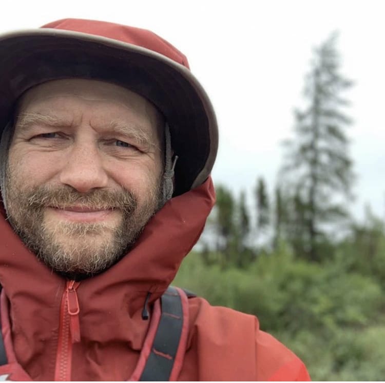
Day 38: Well, I tried. I really really did. Up at 6 AM to break camp, on the water by 8 AM, heading back to make camp again by 8:15. I had convinced myself that the whitecaps just beyond my sheltered they were simply where the wind met the current. Alas, that was not the case. The wind is just as strong as ever and was whipping the water into a froth despite only having 500 m fetch to do it in. Given that it is coming from the Northeast and my whole day is traveling to the northeast across much larger fetches than that travel is basically impossible until the wind dies down.
There are two main land based windspeed indicators around here: larch and spruce trees. Larches are tall, spindly things, so if theyʼre swaying I might be able to travel. But if the spruce are swaying in camp Iʼm staying.
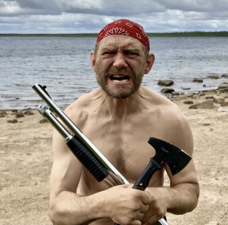
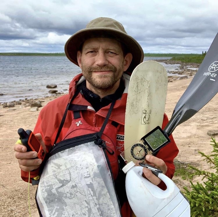
PERCEPTION: I come from the land of the ice and snow
From the midnight sun,
where the hot springs flow
The hammer of the gods
Iʼll drive my ship to new lands
To fight the horde,
and sing and cry
Valhalla, I am coming!
REALITY: With map, compass, GPS, bailer, sail, high tech boat and paddles I am pushing as hard as I can for Hudson Bay while also trying my very best to stay out of Valhalla for the moment!
August 9, 2019
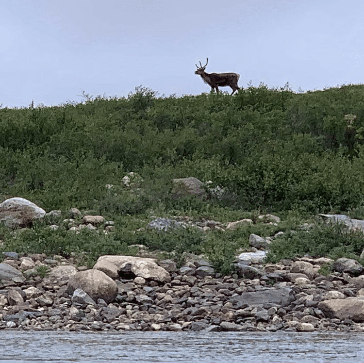
Day 39: I woke up early hoping to make up for lost time but didnʼt even need to get out of the tent to know that that was not going to happen. I could hear the waves crashing on my little bitch and the wind smashing through the trees. I went back to sleep. By noon things were starting to change. The spruce were still swaying, but swaying less wildly. There werenʼt quite as many whitecaps on the water. I took a chance, broke camp, packed the boat, and headed out.
Strong headwinds no matter which way the river twisted meant that I would paddle like I was sprinting for 20 to 30 minutes, then drive my boat up onto a boulder near shore and sit, slumped over, waiting to recover.
Between 1 pm and 8 pm I made 36 km. Itʼs not a lot, given that I was going downriver with the current, but itʼs 36 km I wonʼt have to do tomorrow.
Most respectable wildlife was hiding today, staying out of the wind in the rain, but I did see a few caribou and a few more seal. Makes me wonder where the other marine mammal is, the big white one with giant teeth that eats seal…
I left finding a campsite a little bit too long. By the time 845 rolled around it was getting dark and I absolutely needed to find something quick. The best I could do in the limited time available was a muddy, bushy waterfowl gathering area just to the side of the river. Definitely the least nice campsite Iʼve had to use this trip. Oh well, at least it was horizontal.
August 10, 2019
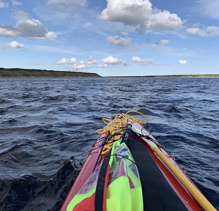
The big push! Bad, bad weather is coming that will strand me on the shore of Hudson Bay with the polar bears for a couple of days unless I get there tomorrow. Fortunately I had an amazing day to do it on, with blue skies, gentle tailwinds, abundant seals and caribou. Not a bad way to wrap up your last full day on the Thlewiaza!
There is something amazing about looking around and seeing yet another caribou bounding along yet another ridge. “There can I see caribou everywhere I look?” Well the answer here is basically yes! Got up at 5 am and was on the water by 630. Paddled right through to 830 pm and was only on shore for 2 short breaks. The paddling plus wind plus current carried my 95 km downriver which, I think, might be a new record for me. It bodes well for being able to make the pickup tomorrow. Once again, a big part of success is simply putting in the time, in this case, hours in the seat of my boat.
Most of the white water today indicated on the map was really just swifts, current and maybe easy class one rapids. The last set I ran though was pretty fun. It was a one and a half kilometers long wave train mixed in with boulder and bedrock ledges, none of them river wide, so it just required some simple maneuvering.

Possibly my last campsite on the Thlewiaza… After a super, crazy long day I basically pounded down a few date-almond balls, set up the tent and bear perimeter, and collapsed.
Oh, I did one other thing too… I used my Garmin InReach to set up a pickup for noon with Joe Savitaaq Jr from Arviat at the river mouth.People might want to know why I don’t paddle the last 60 km from the river to the town of Arviat. The answer to that is easy: it’s incredibly dangerous. Humongous tides, giant waves, impossible to see shore when you’re in water deep enough to paddle in, storms with no shelter and no sleep either because of the very serious threat of hungry polar bears. Just last year an Arviat local was mauled to death by a polar bear in front of his kids just outside of town.
Basically no Inuit sleeps in a tent along the coast and I’m taking that as a message that I shouldn’t either.
Anyway, the hopeful plan is for a pickup tomorrow at noon, boat ride to Arviat, then a shower, hotel bed and a flight!!
August 11, 2019
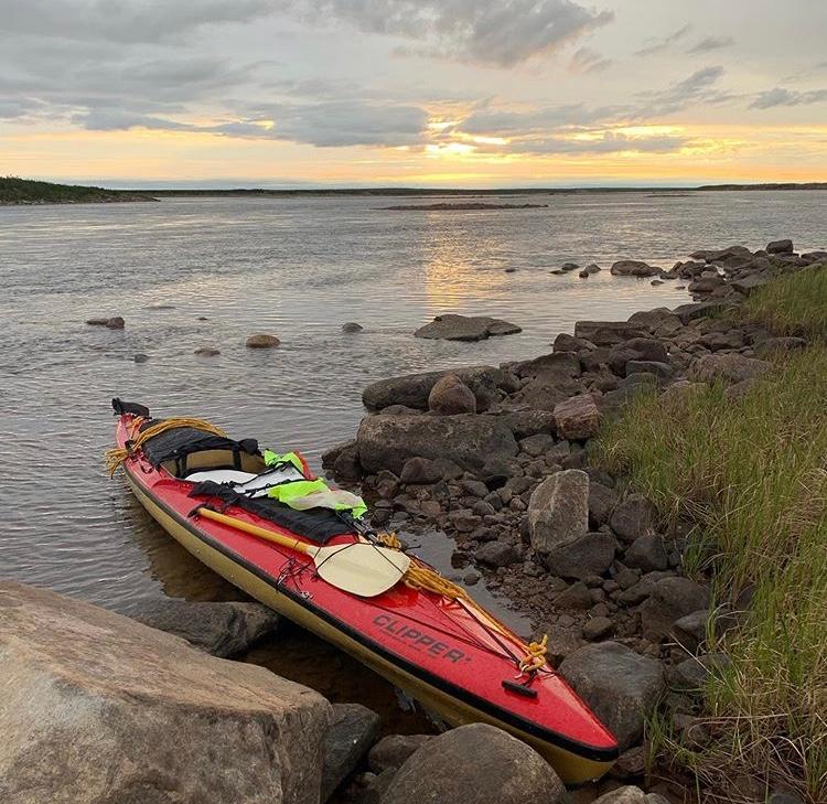
One more day! That’s my fully loaded boat at dawn with 50 km of river to push down before noon. Unfortunately the clouds are moving in and the wind is already beginning to pick up. And it’s a headwind of course (what did think it was going to be?). I’m just above the last serious rapids of the river (I was able to hear them all night). They go on for a long time and have 3 major ledges. The first ledge is formed by a bedrock spine that sticks out from river left so I went in the middle of the now very large river and worked my way to the left after I passed the ledge. Then there’s a big ledge that sticks out from the right side of the river that I was already far away from. Then there’s one more major ledge on the left that was avoidable by paddling back out towards the middle of the river while dodging haystacks, rocks and curling waves. And then on and on, down the river, into the delta and towards the bay.
Navigation is tricky here because of the huge number of islands, very low landscape and lack of trees. How far away is that island over there in the rain? Tough to tell without any spruce to judge the height by. At one point I was relatively convinced that a black moving shape on a hillside was a skinny grizzly bear looking at me only to realize that I had my eyes calibrated all wrong: it was much closer than I had thought and was actually a bald eagle, sitting there in his endless hunt for geese flightless in the summertime.
Normally the front deck of my boat is where I might have my sail, lining rope, maps and compass. Today the sail has been spread out over my lap to help keep me a bit warmer and the shotgun in its case has been added to the configuration. And I’m looking all squinty-eyes and suspicious at every white rock because I have polar bear on the brain.
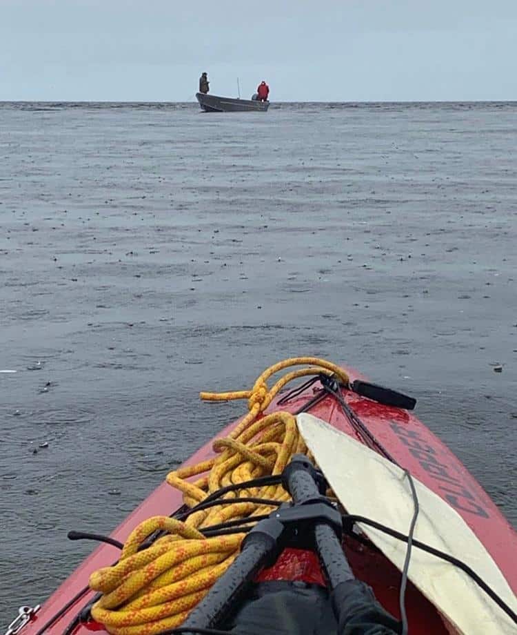
Today ended up being quite a bit more brutal than I had thought. The winds I had been hoping to avoid arrived early and the 50 km that should have been relatively easy for me at this point were one continuous battle. Yes I had current behind me but I also had winds… Basically if I stopped paddling in a minor rapid the wind and the current would equal out and I would drift erratically from left to right.
I pushed downriver as hard as I possibly could, knowing that this was now a make or break situation.
There were minor rapids and swifts the whole way to the Bay, including in the very large delta and the confluence with the Tha-Anne river coming in from the north. If the cold northeaster hadn’t been throwing rain in my face the whole time it would have been incredibly beautiful scenery combined with a fascinating challenge of navigating in the complex Thlewiaza/Tha-Anne delta.
Just as I thought I was getting close to the pickup point I got a satellite text update and found out that the water was too shallow close to shore and the Inuit picking me up had anchored offshore. So now I had an extra 4 km to paddle to get to the boat. It’s quite the trust experiment with your compass and GPS to paddle directly out to sea with only a few exposed boulders of the tidal flats around you, paddling to a destination you can’t see in the fog. Finally, finally one of those boulders slowly resolved itself to become a 20 foot aluminum boat with 2 men inside. They had also hoisted a large orange flag to be more visible. Now things were getting exciting!
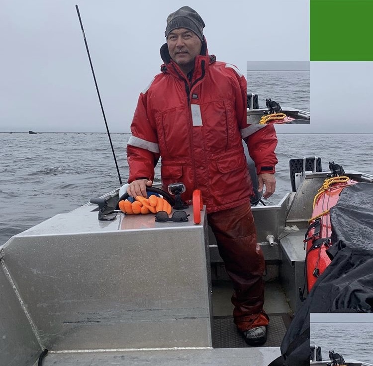
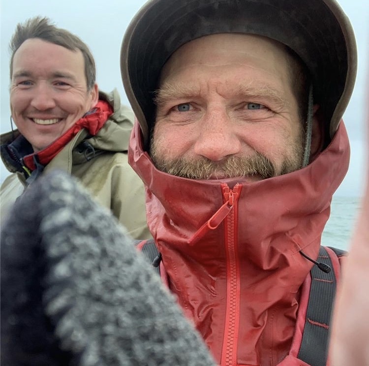
For years Joe Saavikataaq Sr, a wildlife conservation officer, was THE man who would pick up the 2-3 crazy groups of paddlers who would show up on the coast near Arviat each year. And then in 2017 he was elected premier of Nunavut so I figured that he would no longer be doing any more of that.
I spent more than a month trying to find someone else in Arviat to pick me up and had a lot of problems. My backup plan which I was almost ready to implement was to burn my boat at the river mouth and then pay for a $6000 helicopter extraction to Churchill. But then I found that Joe’s son, Joe Saavikataaq Jr, was willing to do it.
So imagine my surprise when in the boat I got two Joes for the price of one, both junior and senior!
So yes, that’s the premier of Nunavut in red at the helm of the boat in the first picture! He was home from the capital for a few days and decided to come along for the ride.
And that’s Joe Saavikataaq Jr in the green, now also working as a conservation officer and picking up his first ever paddler on the Bay. Text him at (204) 599-7182 if you ever need a pickup close to Arviat! Both Joes came across as very very professional, knowledgeable and hospitable. Meeting them was actually one of the highlights of the trip.
The ride to Arviat was 3 hours long. The wind and the waves made it a very cold and bouncy experience. The northern genetics of the two Joes were on full display as they barely needed gloves for the entire freezing ride. “But it’s summertime” they laughed. As we rode along I was so very, very grateful that I didn’t have to paddle this section. The waves from the east were getting bigger and choppier, having had 800 miles of fetch to build up. It would have been a terrible, scary, 3 to 5 day slog.

Getting dropped off at one of Arviat’s two hotels, the Padlei Inns North. I’m very lucky that they had one room available for one night because, not knowing when I would be there, I didn’t have a reservation. So there was room at the Inn, just barely.
So tired. 150 km in 2 days, 50 of which were against a screaming headwind. Then 3 hours of freezing my ass off in an open boat far out at sea.
Went to the Northern Store in Arviat to buy razors and clothes that don’t stink. Took a one hour shower. Shaved. Ate dinner at the hotel. Repacked all my gear. Collapsed.
August 12, 2019
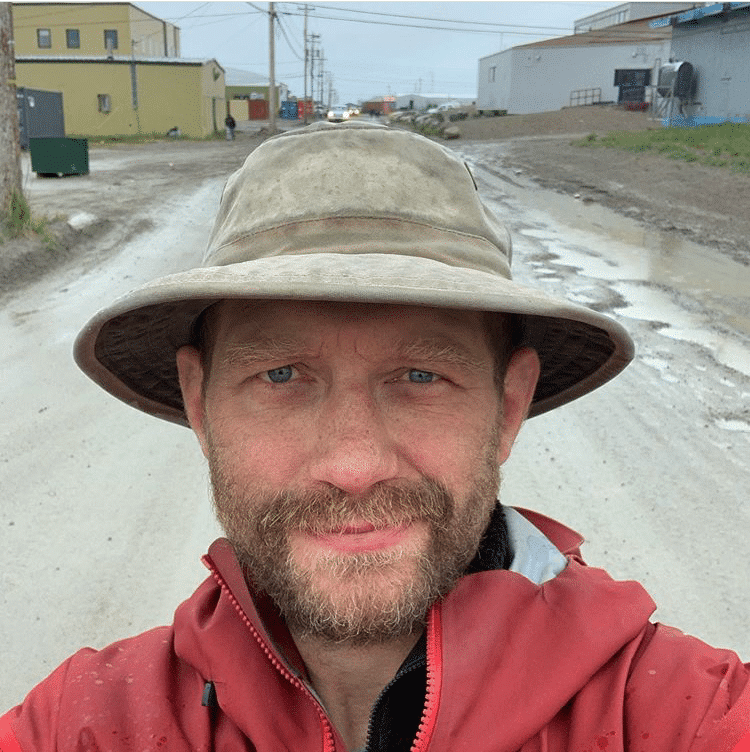
As I look for the meaning of this journey the most recurrent theme is that of hope. 9 years ago I thought I was financially ruined ruined for life. 5 years ago I was on the brink of death from kidney failure. Today I’m homeward bound after completing a huge challenge and having checking off great big item from my life list.
Life is going to kick you in the balls. There will be times you think that you’re finished and out of options. But if you just keep going, kicking, screaming, fighting, scheming, planning and executing then you’ll probably get through it and get back to a place that’s better than before. And really what are your other options? Give up and die? No!! Rage, rage against the dying of the light. Thanks to everyone – friends, kids and family – who helped with this trip and thanks especially to my brother for his incredibly generous loan of a kidney that kept me alive and allowed me to traverse this land of little sticks.
Related Articles
If you liked this then I’ve got two more suggestions for you on this same site…
First is a short story about the 3 days and 2 nights that I spent canoeing to Churchill on Hudson Bay.
Click here for Bears, Belugas and An Offshore Tide on Hudson Bay.
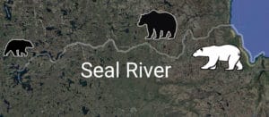
Seal River 2021: Tadoule Lake to Churchill MB
The second suggestion is my account of descending the Seal River in 2021. The highlight of the trip was running into 9 polar bear on Hudson Bay in a 24 hour period!
Click here for the 2021 Seal River Expedition.
The post My Solo 1000 Mile Journey from Missinipe Saskatchewan to Arviat Nunavut, Updates from the Field appeared first on Grapplearts.